
Key Stats for Rho Ridge Trail - 564
About
The north end of this trail appears to have been abandoned by the Forest service, which is unfortunate since it removes access to Mt Lowe, which is a great viewpoint. It no longer appears on their trail inventory. The official start of this trail is at Graham Pass. The north end of the trail is still very accessible and an interesting trip. Care must be taken when hiking any abandoned trail, however.
Trail runs the length of Rhododendron Ridge with some road walking through heavily logged but quite scenic and interesting area. Connects with Burnt Granite Trail 595, Rho Creek Trail 569, Mt. Lowe Trail 562, and Hawk Mountain Trail 564-A. This was part of the Oregon Skyline Trail in the 50s and 60s. This is a very nice under appreciated trail.
Volunteers have been steadily restoring and improving this neglected trail for many years now. The district map is close but not reliable at this time.
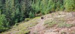
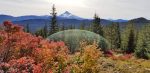
The trail is fairly well signed from Cachebox Meadow north to the 6310 Road — about eleven and a quarter miles. The primary trailheads are at the 6310 Road north of Mount Lowe, at Graham Pass, and at Cachebox Meadow. There are many other access points. Much of the route is heavily wooded and remote in spite of roads. The clearcuts offer views on the south end of the trail. The better alpine settings and views are in the Mount Lowe vicinity. Hawk Mountain is an interesting site and a nice place to camp. The meadows are small but interesting. Botanical interest in places. Water is not available for the most part. There is a spring box beside the trail just south of Round Meadow but it should not be relied upon. There can be water at Fawn Meadow into late Summer. Round Creek dries out by August.
As with most trails along divides, this is a moderately level trail. Trail is blazed for the most part. The grades are easy. The clearcuts through which the trail does pass offer huckleberries starting in August.
Road crossings and trailheads are marked with yellow diamonds.
A good area to spend a couple days exploring.
The 4670 Road is the easiest way to get up to the trail. It’s a long drive regardless.
Graham Pass was named for Joe Graham, a former USFS ranger.1
1Oregon Geographic Names, McArthur, Lewis.
Directions
North Trailhead: Travel Hwy 224 thru Estacada to Ripplebrook. Continue thru Ripplebrook and drive approximately 16.5 miles to Forest Road 4670. Turn right on 4670 and drive approximately 10.6 miles to Forest Road 6310. Turn right on 6310 and drive 1.0 mile to the 6310-040 spur on your left. You can drive this spur but it is getting pretty grown in. It is best to park at wide spot across from the spur road and walk up the road to the trailhead on the right at the top of the short spur. There is no sign.
Middle Trailhead: Travel Hwy 224 thru Estacada to Ripplebrook. Continue thru Ripplebrook and drive approximately 16.5 miles to Forest Road 4670. Turn right on 4670 and drive approximately 14.3 miles to the junction of 4670 and Forest Road 6350. This is Graham Pass. There is a large parking area on the left. The road takes off at the north end of the parking area. There may be signs. At approximately the 12 mile mark on Road 4670 there is an access point as well. There is a sign on the right above the road and a wide spot to park.
South Trailhead: Travel Hwy 224 thru Estacada to Ripplebrook. Continue thru Ripplebrook and drive approximately 16.5 miles to Forest Road 4670. Turn right on 4670 and drive approximately 14.3 miles to the junction of 4670 and Forest Road 6350. This is Graham Pass. Turn left onto the 6350 Road and travel approximately 7.3 miles to Forest Road 6355. Turn right on Road 6355 and travel approximately 0.25 miles to the trailhead on the right. There may be a sign here.
There is also an access point on the 4670-220 spur road, although the trail is a bit harder to locate.
Map and Elevation Profile
Trip Reports
| Photo | Date | Report Summary |
|---|---|---|
 |
Oct 21, 2023 |
Recent maintenance on the north end
Hiked the north end of this trail – Someone has been doing quite a bit of trail maintenance from the north end to the junction up to Mt Lowe – whoever it is – THANK YOU! This portion of the trail was in excellent shape. South of the junction to Mt Lowe the trail gets a little rougher in spots. There is one odd switchback that is easy to miss ...
|
 |
Oct 9, 2017 |
No downed logs
Hiked the south end of this trail (to Hawk Mountain). The trail from the 6355 road to the junction with the lookout trail (564-A), was completely free of downed logs and in great shape. It looked like it might have gotten a little brushier past the junction – I’m guessing most people use this to get to the cabin, so that 2 miles of trail gets ...
|