You're right, Don. It's the Cottonwood Meadows Trail.
Here we go again, but this time it will be an abandoned trail in our district. This trail sign is at a junction in the trail, and it is not in a wilderness area.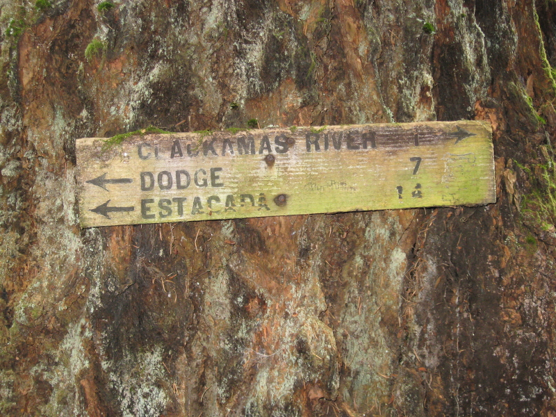
Wow, Don, you are good! After you posted that, I knew you were right. It looked to me like the trail was going uphill (which it obviously isn't), which threw me. I really like that trail....Hopefully they won't close the 5830 road and we lose access to it!
As for your new photo, I'll have to scour the map for that one. It looks REALLY interesting!
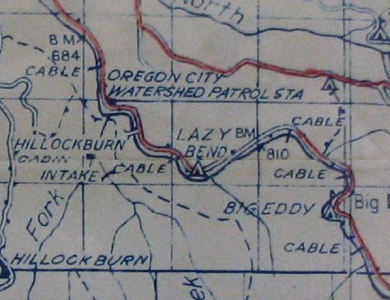
I found Dodge, but without some other clues, I'm not sure where this trail is. I'm thinking it is somewhere around Hillockburn or the South Fork - maybe the trail that goes above the river?
Rob Williams said:
I found Dodge, but without some other clues, I'm not sure where this trail is. I'm thinking it is somewhere around Hillockburn or the South Fork - maybe the trail that goes above the river?
Rob you are about as close as you are going to get. I don't know the name of it, but it ties into the Memaloose Trail, once it crosses the South Fork at the mouth. It went on down to Dodge, but most of it was probably wiped out by the road building and logging. Anyway, the sign is still there along the trail near where there is suppose to be a junction with the trail to the Hillockburn Cabin, but we haven't been able to locate that one yet.
The trail is fairly easy to follow once you are at that sign and head on down to the South Fork. There is a 1-2 mile hike in on a logging road and a 1/4 mile bushwack to get to the sign. You kind of have to have someone show it to you the first time, or you will probably miss it entirely.I include a portion of the '52 Blue map that we have on the website that shows the trail.