
Paul Turner said:
Don,
In a previous post you mentioned a trail on the '38 map between Switch Creek and Lost Creek connecting the trail along the Clackamas R with the one running along the rim around Oak Grove Butte, so I'm guessing it is that one.
BTW, I visited both the Lost Creek trail and Switch Creek trails yesterday for a couple of hundred yards each – I didn't see any obvious trail. Switch Creek looks the nicest, given the size of the trees in there I doubt that piece has ever been logged.
–Paul
Paul you are correct, it is the cutoff trail between what I call the old Upper Clackamas River Trail in the bottom of the canyon and the Oak Grove Butte Trail up on the ridge. Here is a portion of the '38 with the trail on it.
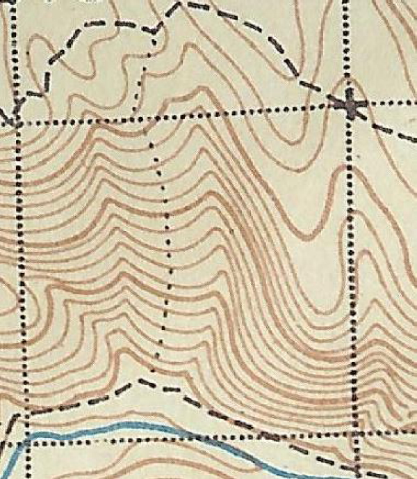
But as I had mentioned before, the trail actually follows a ridge one to the east of the one shown on the map.
As for the Lost Creek Trail I haven't had any luck locating that one yet, but I haven't spent much time at it either. The Switch Creek Trail is there and ties into the Oak Grove Butte Trail about a 1/4 mile below the 4640 road and brings you out at the 157 spur road. From there on up I haven't found anything yet, but about an 1/8 mile of tread coming from the old lookout site south. I did locate about a 1/2 mile of the old Oak Grove Butte Trail heading back towards Austin Meadow before it ends on an old logging road. The rest of that trail is pretty much gone except for a few 100 feet because of all the logging and road building. I think it would make a good starting point for someone, like yourself who wanted to bushwack through the old growth west onto the rocky bluffs down river and coming out at the junction of the 46 and 63 roads.
When the snow finally melts up on high, I will get back up there and look around Oak Grove Butte and east.
Don,
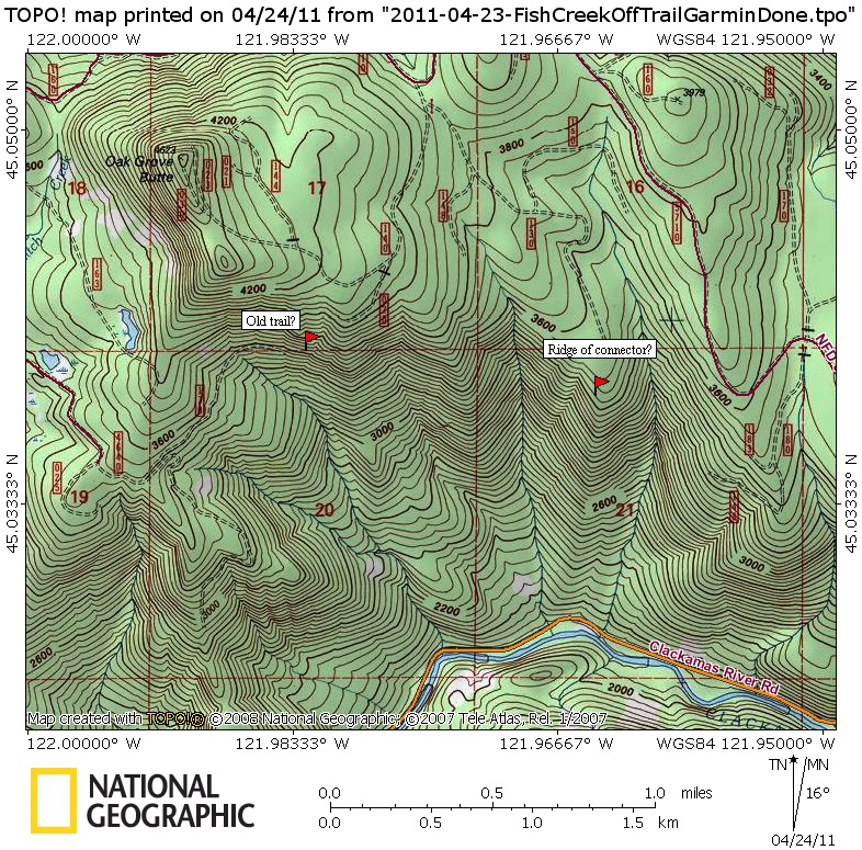
I'm not clear on which ridge the connector is. Have I located it properly on the following map? Also, on the '38 map there is a trail that runs across the south face and looks to be aligned along the marked road fragment, is there anything there?
I've got no picture to carry on, I'll try to round up a map fragment.
Thx,
--Paul
OK, try this one,
Here is a map fragment consisting of 2 trails intersecting, the one I'm interested in is the dotted trail on the eastern end and going south, what peak is this trail's destination? I hope to put these 2 trails together for a loop sometime this season. 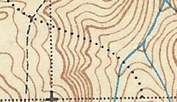
--Paul
Paul Turner said:
Don,
I'm not clear on which ridge the connector is. Have I located it properly on the following map? Also, on the '38 map there is a trail that runs across the south face and looks to be aligned along the marked road fragment, is there anything there?
I've got no picture to carry on, I'll try to round up a map fragment.
Thx,
--Paul
Paul this is what I think I have found on the ground, but it hasn't been verified with a GPS unit. The blue line is a decommissioned road and the red line is the trail that I have been up so far once last month. Like I said it goes up one ridge to east of where it looks on the map. I turned around in deep snow before I ran into any roads, but I am sure I will when I get back up there.
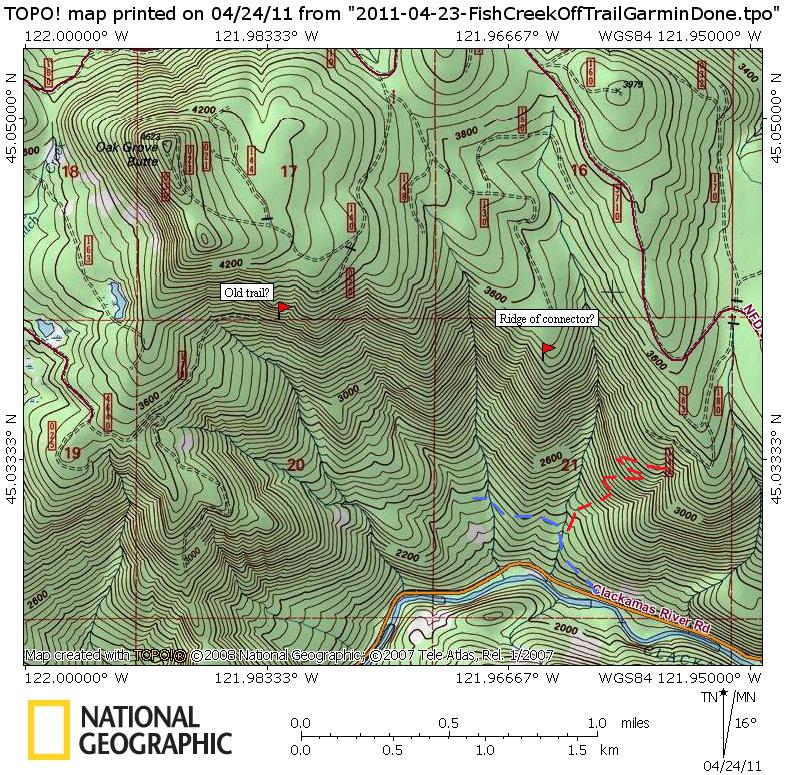
As far as the trail heading east at the end of the road, I haven't been there yet. I have been up the ridge that comes from the SW of Oak Grove Butte, but not from the SE or on the segment that goes where your road is depicted. When the snow melts, I plan on checking it out.
Don
Paul Turner said:
OK, try this one,
Here is a map fragment consisting of 2 trails intersecting, the one I'm interested in is the dotted trail on the eastern end and going south, what peak is this trail's destination? I hope to put these 2 trails together for a loop sometime this season.
–Paul
That looks the trail up to Wanderers Peak after crossing Memaloose Creek.
Don