Donald Presley said:
[...]
Here is a picture of the benchmark, it is the only one I have seen like this.
That's an interesting marking, is it the tree bark spreading that distorts the letters? Looks like it.
[...] And that trail switchbacking up the ridge just to the north of the cabin I haven't been able to locate it yet, and it ties into the Oak Grove Butte Trail. Where I thought the trail was is now a clear cut. Having only spent a few hours looking for the trail so far I haven't given up on it yet, for sometimes the trail is in the wrong place on the map, or the map omits ridges or creeks.
I hope to get up there this spring when the snow melts to look for that trail as well as others in the upper Clackamas River area.
So it is your turn to post another map segment or photo of a trail in our district.
Don
Don, I've got a hike planned starting from the trail that used to go up Switch Creek, which I believe you have mentioned a time or two, then on up to the former lookout site (are there any views there?) then make my way east by whatever means to follow the route you mention here that follows Lost Creek (the 1956 map calls this the Pot Creek Trail). I'd do it as a loop either bike and hike or follow the road and get on what I believe is a trail you mentioned in a previous post that is is above the road. Have you explored the Switch Creek portion to the old lookout? Assuming there is a segment above and following the road, how much of it is there between Switch Creek and Lost Creek? I figure about 3000' elevation gain to the lookout site, it would be great to have a trail through this area.
--Paul
Paul
How have you been? Don't hear from you much these days.
There is an old trail going up Switch Creek that is fairly easy to follow once you get up to the crossing and on up to the 4640 road. From there onto Oak Grove Butte, I haven't had much luck in locating the tread for I believe most of it is under roads. I did find a faint trail coming south / southeast from the old lookout site for about a 1/4 mile, but haven't tied it into anything yet. There are some nice veiws from the old lookout site.
As far as going from Oak Grove Butte to the Pot Creek or the Lost Creek Trail, you are pretty much on your own, for I haven't even looked in that area yet, otherthan trying to come up from the Pot Creek Cabin and looking in a clearcut where I thought the trail should go.
I have found a segment of the old trail that came along the river a mile or so above Austin Hot Springs that they didn't get wiped out with the 46 road. Actually there are a couple of segments, but the road keeps cutting it off. The old '38 map shows 2 trails east of the hot springs, and I believe I have been on parts of both of them, but the upper one is so faint it is hard to follow and the lower keeps getting eaten up by the road that I have almost given up on that section.
This last month I did locate part of a faint trail coming up out of the canyon, that dotted trail travelling due north, that joins up with the Oak Grove Butte Trail 1-2 miles to the east. I was getting into deep snow and didn't have any flagging with me, so I was unable to mark the trail, but it wasn't that hard to follow once you got up the ridge a ways. That trail is not on the ridge as marked on the '38 map, it is one ridge to the east.
So many trails, so little time to locate them, let alone try to hike all of them.
Don
Donald Presley said:
There is an old trail going up Switch Creek that is fairly easy to follow once you get up to the crossing and on up to the 4640 road.[...]
Don,
Thanks for the information, this is going to be fun route to follow assuming the rain/snow ever stops.
This last month I did locate part of a faint trail coming up out of the canyon, that dotted trail travelling due north, that joins up with the Oak Grove Butte Trail 1-2 miles to the east. I was getting into deep snow and didn't have any flagging with me, so I was unable to mark the trail, but it wasn't that hard to follow once you got up the ridge a ways. That trail is not on the ridge as marked on the '38 map, it is one ridge to the east.
Interesting, I'll definitely need to explore this one. Would make for a shorter loop than the one I have planned.
So many trails, so little time to locate them, let alone try to hike all of them.
Don
Speaking of which, have you ever gone south from the Fish Creek Mtn trail to follow the Fish Creek Divide to East Mountain? This is another hike I have planned for this season.
Thx
--Paul
Paul Turner said:
Speaking of which, have you ever gone south from the Fish Creek Mtn trail to follow the Fish Creek Divide to East Mountain? This is another hike I have planned for this season.
Thx
--Paul
Paul I haven't looked for that trail south of the Fish Creek Mtn. Trail to East Mtn. yet, but it is on my to do list. I know there is a decommissioned road along alot of that ridge.
I am patiently waiting for the snow melt to get back up to Oak Grove Butte to look towards the east and locate where that one comes up out of the canyon as well as on towards Pot creek.
Don
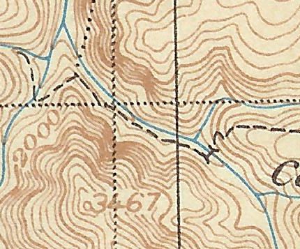
OK, I've finally found a spot on an old map that looks interesting. It is from the '38 map, which is posted here, in the section that says ClackamasDistrictMap-38.
This section is from one of my favorite areas in the district. I have no idea what this trail is named, but it would be an interesting place to visit: