
Here is a link to a posting that Don did quite a while ago. We've had a couple of map postings, but it would be good to get something like this going. You can look at the old maps we have on the maps page, or scan in a portion of an old map you have. It needs to be a relatively small section, but have something that someone could key off of to find the trail. It is an interesting puzzle I think.
So everybody seems to be out of photos, just like me. Here is a map segment with a trail on it. You tell me which trail am I on. It is a portion of the '38 Mt Hood Nat'l Forest map. I like this map, with all of it's faults, because I happen to own a copy. It has a scale of 1/2 " per mile, but it's beauty isn't seen until you blow it up.
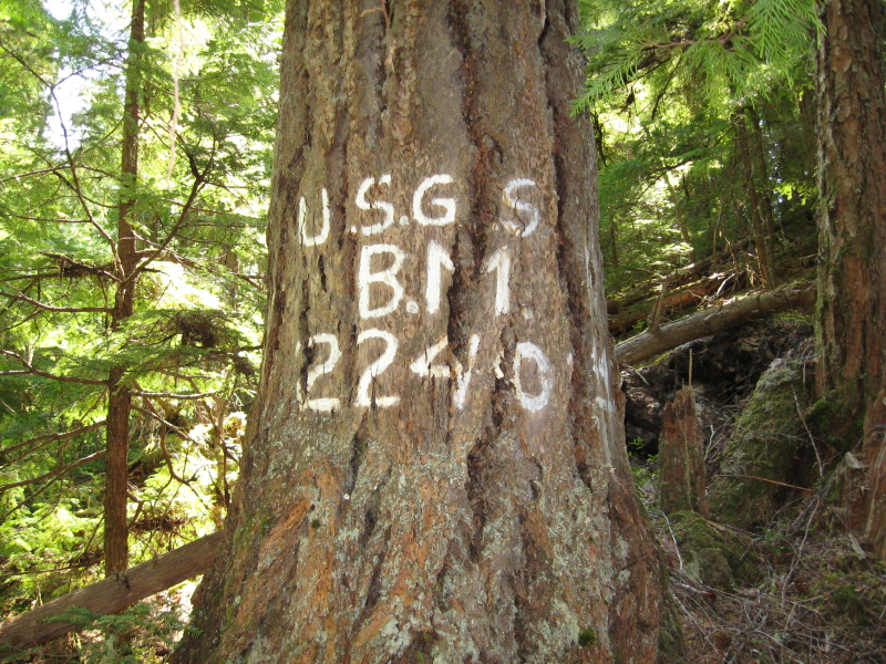
I have been to the benchmark on this trail.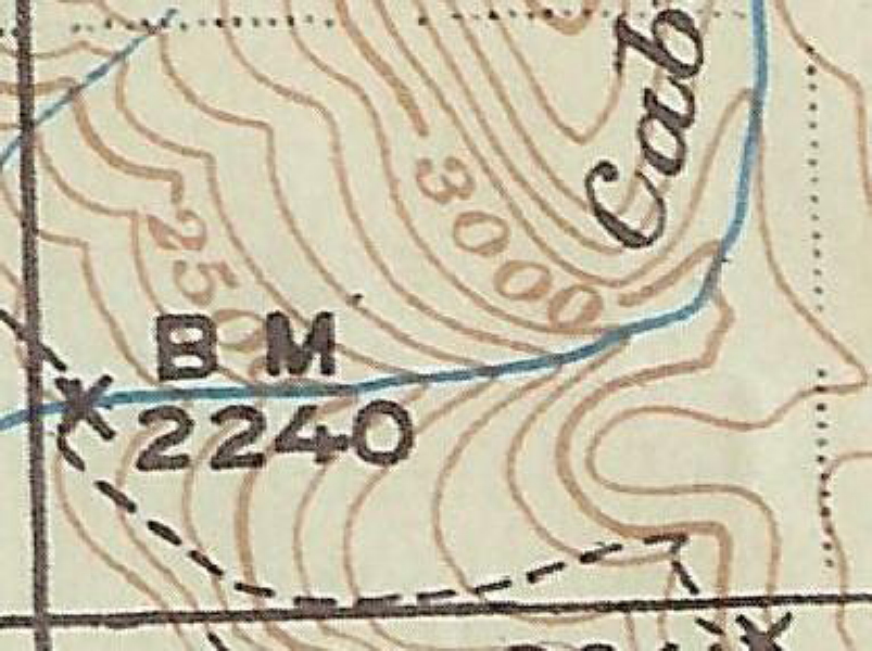
The map segment I posted hasn't drawn any response, so I thought I should give another clue.
The section of trail with the benchmark is about a 1/2 mile from the upper Clackamas River.
Don
I'm not sure of the name of the trail, but it is in the Big Bottom area. The creek shown is Cabin Creek.
I see reference to a "Pot Creek Cabin" just north of there - do you know if any remnants of that cabin are still there?
Rob you are correct. I don't know what the name of the trail was either. I do know that the benchmark is still there and that the trail was made into a road at least in that area and later abandoned. If I show a larger view of the map segment the trail location is obvious with Big Bottom nearby.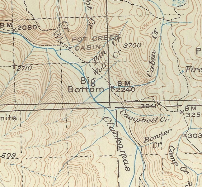
Here is a picture of the benchmark, it is the only one I have seen like this.
As far as the Pot Creek Cabin, I have been to the site, but there isn't anything left. It is an offroad campsite in a grove of old trees at the present time. And that trail switchbacking up the ridge just to the north of the cabin I haven't been able to locate it yet, and it ties into the Oak Grove Butte Trail. Where I thought the trail was is now a clear cut. Having only spent a few hours looking for the trail so far I haven't given up on it yet, for sometimes the trail is in the wrong place on the map, or the map omits ridges or creeks.
I hope to get up there this spring when the snow melts to look for that trail as well as others in the upper Clackamas River area.
So it is your turn to post another map segment or photo of a trail in our district.
Don