
Well, I don't have really anything to post if I get it right, but I really enjoy looking at those old maps. I thought that point might have been mistletoe - I remember you talking about it.
I'm thinking the trail you are thinking of is one of two trails:
- The old Pup Creek Trail that comes down kind of from Whalehead
- The trail that goes along Bull Creek - looks like it hits the old railroad grade and it even looks like there is still a piece of trail going up to Surprise Lake (at least on the current MyTopo maps):

Rob you are right, when you said it was the trail coming down Pup Creek from Whale Head. It didn't come down Cat Creek as the '38 map shows as you know, for we have hiked down that segment. The trail went from the Clackamas River at Pup Creek all the way south to Thunder Mtn and onto Baty Butte. The Fish Creek Mtn Trail is a segment of that trail. The photo was taken from an abandoned segment between Whale Head and Fish Creek Mtn.
This portion of the the '38 map shows where I took the photo by aligning Oak Grove Butte with the small knob known as 'Mistletoe' near Sandstone Creek :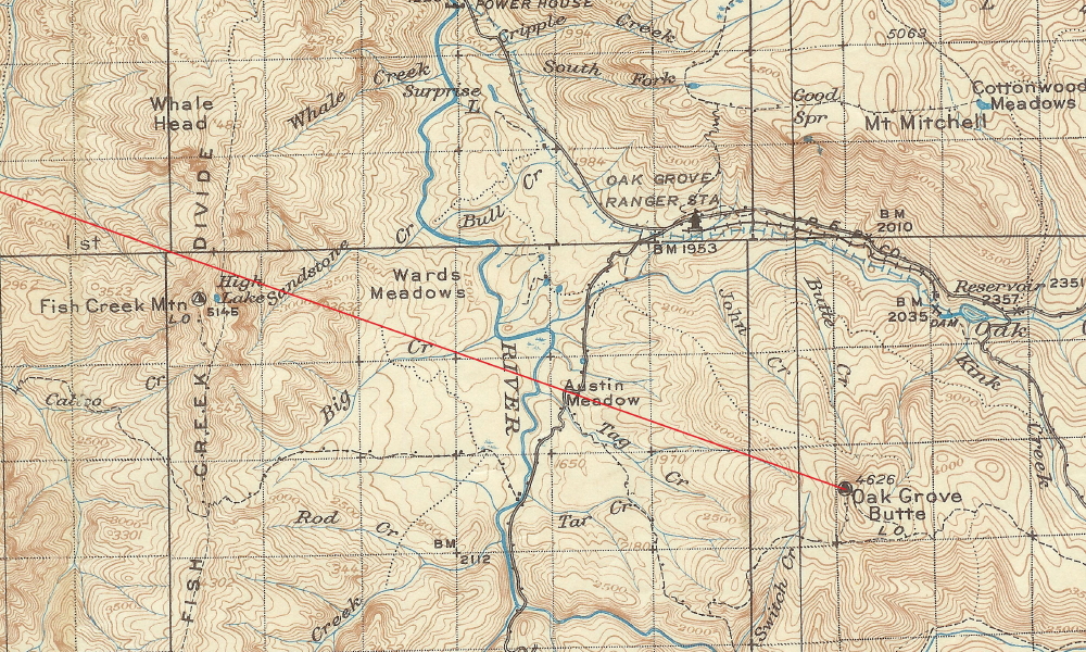
Hopefully whenever the snowmelts this spring or early summer above 4000 feet, I can take you up there. It was snowing up there again today around 2500 feet and higher. I was up the Clackamas doing my annual Chainsaw/Crosscut saw certification class with the Forest Service. We were across the road from the Lazy Bend Campground doing the cutting portion of the class where we only got sprinkled on, but when I drove home I could see from pass above North Fork Reservoir that it was snowing up higher.
Might have to run up there tomorrow and play in the new snow.
Don
Well, if nobody else wants to start the ball rolling again, I guess I will.
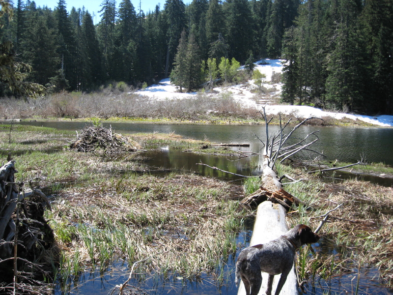
This photo was taken a few feet from an abandoned trail that I am sure starts in our district, but is out of district in this photo. The photo was taken during a spring hike, or more of a bushwhack to a lake to see what it was like.
Any hints as to where it might be? It doesn't ring any bells for me....
You will need to look along the western edge of the district to find the lake. I believe it was an old BLM trail. I neglected to take a picture of the trail sign and I have yet to find the trail on a map.