
Okay Don, you made the correct ID for the last picture. It's your turn to post a picture.
I was going to post something last night, but got busy with family.
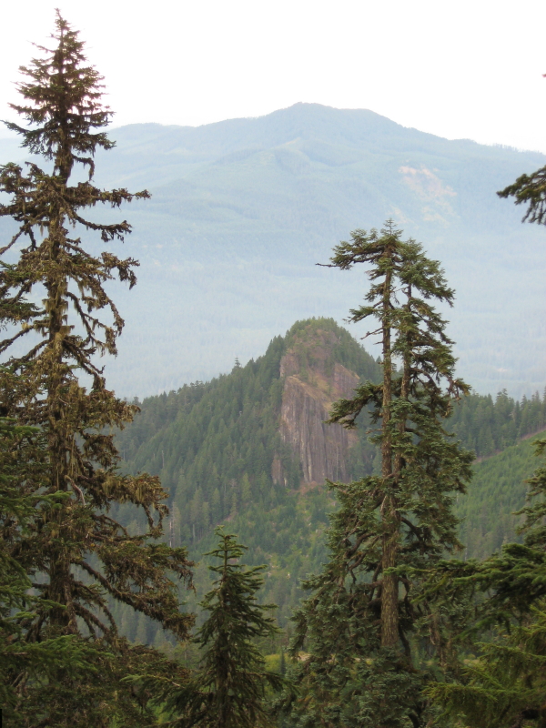
In keeping with geological features seen out there on the trail or off, I submit the following photo taken from a trail in our district.
There were no replys to the photo I posted over the weekend, so I thought that I should give another hint.
The prominent point on the ridge in the background was once a site of a lookout.
The rocky knob in the foreground I believe was a volcanic vent. The cliffs are 100-200 feet tall and seem to be made of fused cinders and rock. I had taken my children to the top on several occasions in the past 20 years for it is an easy scramble on it's eastern face, that is not shown in this view.
Don
Still no replys. The high point in the background is Oak Grove Butte, and by the way, this trail is one of the abandoned ones in our district. So you will have to get out an older map, or search the ones on our website, to locate this trail.
Here is another hint. Sandstone Creek is between where this photo was taken and the prominent rock formation in the foreground. You can line up Oak Grove Butte and this knob, which I believe they call 'Mistletoe', and you will get a line that intersects this old trail. You will need to look at the '38 or '46 maps to see the trail.
Don