
Donovan said:
Is that the walk out Indian Ridge to Shining Lake?
A little too far North. This particular section of the trail may not be officially maintained.
Doug,
Your last photo posting for What Trail Am I on? got me thinking. I hadn't been on that trail, so I looked it up on our current district map. I noticed that the trail to Welcome Lakes had two different numbers, depending on which direction you came from. It was the #554 if you came from the east up from Elk Lake Creek, or #556 if you came from the west from Big Slide Mtn.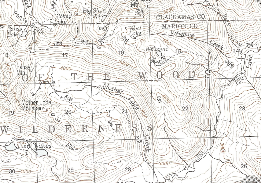
I thought that was odd, so I looked at my Green Trails Battle Ax map and it showed me the real picture. The west portion of the #554 had been taken off the map as well as the infamous Geronimo Trail that plunges down off the end of the ridge. All that I could find of the Geronimo Trail on our current district map was that they left the 557 number on the ridge, but without the trail.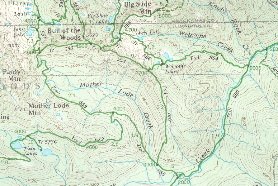
So that brings me to the question of your photo and where that trail sign is. Having never been where that photo was taken, I came up with 4 possibilities:
1) the junction w/ #555 on the ridge to the west,
2) further down that same ridge at the junction w/ #557 Geronimo,
3) at the junction where #556 and #554 meet near Welcome Lakes,
4) at the trail junction on Elk Lake Creek Trail #559.
Am I even close, or is there other possible places for that sign?
Don,
The Trail 554 photo was taken at the lower end of the Welcome Lakes trail where it meets Elk Lake Creek trail 559. It's not far from the point where trail 559 fords Elk Lake Creek.
It's interesting that the District map doesn't show the upper end of the 554 trail from Upper Welcome Lake to the Mother Lode trail. Although I haven't hiked that particular stretch of trail in a few years, the last time I was on it, it seemed like a perfectly good trail. Cartographer's error, maybe? I can see removing the Geronimo trail from the map as it is officially abandoned and unmaintained, but they may have inadvertently removed more trail from the map then just the Geronimo trail.
Here is a photo from one of our abandoned trails in the district, that I believe should be brought back into the current district trails. Enjoy the view.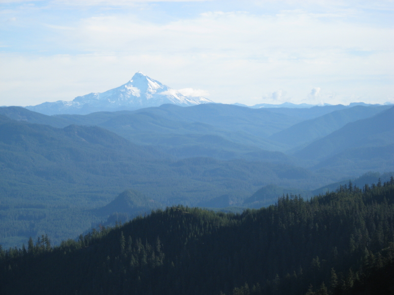
Well, since no one has had a new guess on my trail, I'll put out one more clue - this particular location was the site of an old lookout.