
Yes Don you are right Sounds of Two Rivers bench camp(?), but I am not sure that's BG in the distance, but rather simply high ground across the canyon. Tail of Whale maybe.
There is a distinct location at Baty Guard Station. The stove top remains in the fire pit. A rudimentary spring. A potty. And it seem to me there may have been a rudimentary shed for the horse.
In the 80s Lost Creek was stripped by the BLM. The slash burned so hot the soil was fried and eroded so heavily that the trail was obliterated. This info is from a relative who ride horse from Dodge to Bagby in the 70s. They tried it again but the logging spoiled the day. There are a few ribbons of timber where the trail has been found according to a friend along the bottom. I have looked hard for the switchbacks shown climbing the wall northbound from the saddle above. No trace. But from there north to South Fork Mountain there is much of it follow. It crosses the road many times. At Miners Butte it runs quite a ways below the road.
The Junction with the High Camp Trail is in a saddle but all cleared off ground.
Some older maps show the trail over Bracket Mountain. Several I know have scouted around up there but there is nothing definitive. It may have been faint anyway.
D.
Yeah I was mistaken about the background mountains, I guess I thought I was up on the Switch Creek trail. Both the Sounds and Switch Creek trails follow a ridge up out of the canyon and have a flat bench part way up.
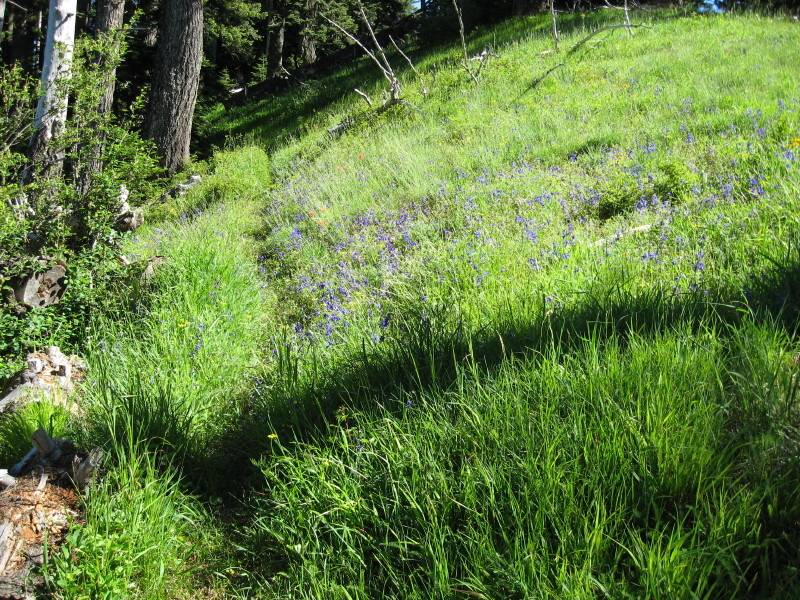
I have got to get some more photos of trails in our district, for I think I have exhausted my supply. I hope this photo of a current district trail isn't too easy:
That view looks a little familiar. Except, I think it was covered with snow when I saw it and I was with you and Rob. Have I been here with you when it was covered with snow? On second thought, I think I'm wrong because the shadows seem to be wrong.
I'm thinking that is the Fish Creek Mountain trail, on the old (original) part of the trail partway up. I remember a hillside meadow like in the photo.
Kirk Tolstrup said:
That view looks a little familiar. Except, I think it was covered with snow when I saw it and I was with you and Rob. Have I been here with you when it was covered with snow? On second thought, I think I'm wrong because the shadows seem to be wrong.
I have never hiked this section of trail in the snow before, because you usually can't get to the trailhead in the winter. I usually get up there in May or June, and there is usually some snowdrifts up on top but not in the section of trail the photo was taken from.
It was beautiful up the Clackamas today, no fog from the NorthFork reservoir upriver, but there were some icey spots in the canyon past Three Lynx that you had to pay attention to. It was a great day to get out in the woods.
Don