
So I'm a little confused. The trail that Don posted is the South Fork Mountain trail? South Fork Mountain (at least the one I know) is significantly north of Baty Butte. Am I missing something?
Please educate me...Or maybe I'm just being slow on a very rainy Saturday morning.
Rob Williams said:
So I'm a little confused. The trail that Don posted is the South Fork Mountain trail? South Fork Mountain (at least the one I know) is significantly north of Baty Butte. Am I missing something?
Please educate me...Or maybe I'm just being slow on a very rainy Saturday morning.
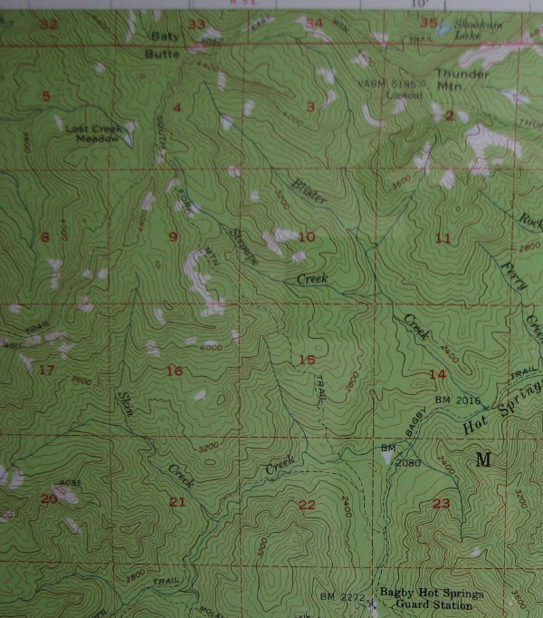
The South Fork Mtn Trail formerly went from Estacada to Bagby as mentioned on our website under the Baty Butte Trail. The following image is a portion of 1956 Bagby Hot Springs topo , that I cropped from an image also from our website from the O of U photos, with the trail coming down from Baty Butte and going to Bagby labeled as the South Fork Mtn Trail.
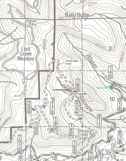
This other image is a cropped one of the one I posted last night that may show my markings of the trail on our current district map a little more clearly.
Don
Don, thanks for the clarification. After looking at those 1956 maps, I see the trail clearly. That was a long trail!
Kirk: Is that the Table Rock trail? It kind of reminds me of the rock field you approach before you get to the basalt wall....
Exactly Rob. If it's ever my turn again, I'll try to make it more challenging. Your turn!
Donald Presley said:
Kirk Tolstrup said:
Don, I forgot to ask if that bridge goes over Stroupe Creek? How old do you think that bridge is?
Kirk, it actually paralells the creek and is probably a 100-200 yards or so below a previous trailhead back in the 60-70's near the 160 spur road crossing of Stroupe Creek. I would think that the footbridge would be at least 50-75 years old and is similiar to others I have seen on other abandoned trails.
Don
Isn't there a waterfall nearby the bridge?
Don,
No, I haven't looked for that end of Nohorn. I have found a part where the trail comes out of the creek towards the divide but was never able to get anything good strung together on account of the very extensive harvest history in the boundary area.