
Kirk Tolstrup said:
South Fork Mountain Trail?
Donald Presley said:
Kirk Tolstrup said:
South Fork Mountain Trail?
You are correct Kirk, so you will have to post the next photo.
We currently only use about a mile of this trail to reach Baty Butte, but segments remain all the way down to Nohorn Creek that didn't get logged or roads built over it. Our district map doesn't even show the Baty Butte Trail.
I insert a portion of our district map with some of my scratchings on it, but it hasn't been verified by a GPS yet. Be aware that these abandoned segments hadn't seen any maintenance for 50+ years, basically bushwacking. I have been on most of these segments only once or twice, they are pretty faint.
Don
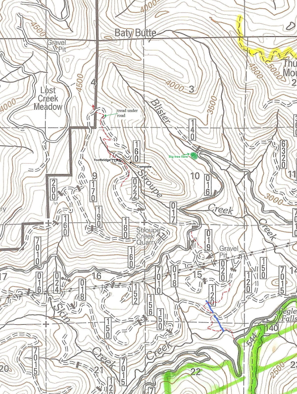
Just to note, the trail in red.
Don, Have you snooped along Nohorn Creek yet?
Sorry about the map not being very clear, but when you reduce it you loose some clarity. I haven't been up Nohorn yet, but it is on my short list. Have you wandered up that way any?
Don
Here's a trail that's not in the Mt. Hood NF. It's only a few miles out of the NF.
Don, I forgot to ask if that bridge goes over Stroupe Creek? How old do you think that bridge is?
Kirk Tolstrup said:
Don, I forgot to ask if that bridge goes over Stroupe Creek? How old do you think that bridge is?
Kirk, it actually paralells the creek and is probably a 100-200 yards or so below a previous trailhead back in the 60-70's near the 160 spur road crossing of Stroupe Creek. I would think that the footbridge would be at least 50-75 years old and is similiar to others I have seen on other abandoned trails.
Don