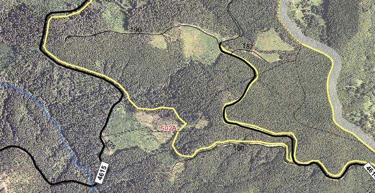
Maybe it is. I can't keep all of the wilderness areas straight! I just looked at the wilderness maps here on the site, and if I am reading them correctly, the beginning of White Iris is in the Eagle Creek Wilderness area, but before it hits the 4615 road, it exits the wilderness. But you are correct, the portion where it crosses the 4614 road is part of the wilderness area.
I didn't realize that area was wilderness....I've added the Eagle Creek wilderness map to the site here.
It's kind of tricky whether to call it wilderness or not. If I remember correctly, we were pretty close to the road when that picture was taken. How far do you have to be from the road before you would consider yourself in the wilderness area?
If I'm reading the map correctly, I think the trail exits the wilderness about the place where that large tree is (where we lost the trail). The crossing at 4614 looks like it is in the wilderness, which sounds really weird - there is a road running through the middle of a wilderness area? And a paved road at that? Am I mis-reading the map? Does it look like the 4614 road is a sliver of "non wilderness" area right in the middle of the wilderness?

Yeah, I've noticed that with the expansions of the wilderness areas that there will be an existing road that's left as an access sometimes. For example the road into Frazier Turnaround, and the road to Grouse Point trailhead.
I think you guys need to enjoy those roads while you can. They may be waiting on new additional funding to rip them. A long wait hopefully.
One good thing about those in close wildernesses, is that they might be more likely to dowse the fires when flames and smoke are visible from Portland, hence perhaps to keep the roads.
D.
