
Some clue D. I was thinking that is was the Alder Flat Trail before the plaque, but now I am not sure. You say Riverside, maybe? I need to get out for a walk this weekend and the snow level is suppose to come down to 2000', so those trails maybe good prospects for an outing anyway. I said walk and not a hike, for these trails are basically flat with little elevation gain, but will get you next to the Clackamas River. When the snows really come down low, these trails can be a delight on showshoes when the conditions are right and you can get there.
Don
So where does that leave this clue? No one has posted anything in a while? Did anyone go take a look at the Riverside and/or Alder flat trails to see if they could reproduce it?
Just curious....The silence is deafening!
Like I said, it was in my file of Riverside pictures, but it pends verification.
D.
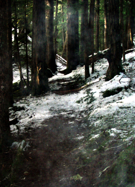
Well, no one seemed to want to go check this out, and I really wanted to get out in the woods today, so I went and validated where this is. I'm very sure Donovan's notes were correct. I think my photo was taken just about where his was (within a few feet, anyway). You can see the downed log on the right (under the snow) and the large downed log in the background on the right. The photo was taken on the Riverside trail near where the Boy Scout bridge used to be (more on that in a moment) Here is my photo - please excuse the "smoky" effect - I'm not sure what it was from - maybe my breath or something, but this was the photo most like the one Donovan posted:
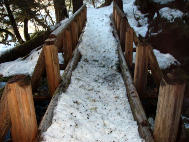
So, the next thing in the boy scout bridge over tag creek. I thought it was over Tag creek, and looked back at the last time I hiked Riverside (2008) and I found this photo of that bridge - at that time the handrails were coming off:
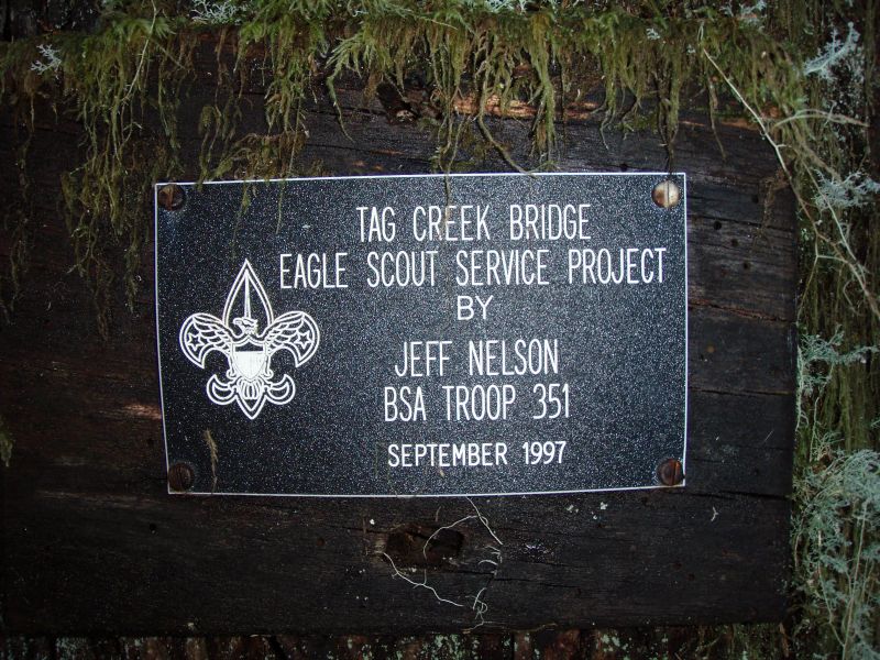
Here is the nameplate that identified it as a Boy Scout Eagle Project that was lying on the ground on one end of the bridge (the wood had rotted and fallen off a tree).
Here is the "new" bridge - I could see remnants of the old bridge in the creek:
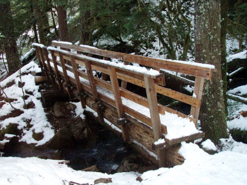
I think it is kind of sad that old Boy Scout bridge was replaced. I'm a bit surprised it lasted less than 15 years - it looked to be pretty stout to me.
Thanks Rob for checking that trail out. I was going to go up the river tomorrow and was thinking of doing the Riverside Trail to see if that was the trail in question, but now I can go somewhere else. I will probably go on an abandoned trail so that I can climb out of canyon and Murphy can play in the snow.
How deep was the snow? I was thinking of throwing in my snowshoes or crosscountry skis just in case I would get a chance to use them. This will probably be my last hike for awhile, so I thought I would make the most of it.
Don