
I like the What trail am I on? game that we have recently started on this website.
But apparantly I don't have enough usable photos of our district trails to be able to
post more than just a couple of trails. As an alternative to that game may I suggest
one that uses a small section of a map instead. A map version of What trail am I on?
The maps used would be limited to those on our website, so everyone would have
the same sources to work with. You would have to copy one of our maps, or one of
the more recent photos of maps from the U of O library that have been added to our
maps collection to your computer and crop a small portion of the map containing the
trail in question and posting it back on the website.
Here is what I came up with as far as rules of the game (subject to change):
- what map used must be stated (example; 1938 Mt Hood Nat'l Forest map)
- the trail can be a current or lost or abandoned district trail,
after all we are advocates of the Clackamas River Ranger District
- the smallest the image can be is one section (1 square mile)
- the largest the image can be cannot show more than one entire section,
but numerous partial sections alongside is ok
- no larger than 800 X 600 pixels images
- answer any questions posted about the image
- the one who identifies the trail gets to post the next one
The 7.5 and 15 minute topos being on the easy end and the Mt Hood Nat'l Forest maps
being on the harder end. Remember that the trail must be within our district.
So all of you cartographiophiles, who can hover over an old map for hours on end (me included),
dust off your mapping skills and take a stab at this new game.
Tell me what you think of this idea?
This is a sample map of the proposed map version of What trail am I on?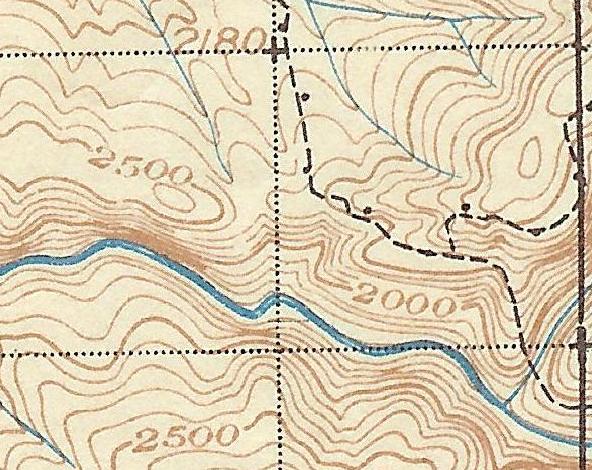
This is a section of the '38 Mt Hood Nat'l Forest with the trail in question coming up the ridge in the bottom right hand corner.
Tell me what you think of this idea of a map version?
Well Don, I like the idea, even though it hasn't gotten much response yet. I'm guessing it is just due to people being busy over the holidays....
Happy New Year!