Went up to Pansy Lake to explore the old mine(s) and see what else we could find. I had some notes from a long time ago talking about an "old horse camp area". We didn't have much luck finding that - I think we may have found the old watering hole, but no remnants of a horse camp.
We did find at least one old mine:

And also an old generator near the mine - I'm amazed they actually lugged this beast in here!

We also found the old trail that used to go north to Bagby - we followed it a little ways, but following it farther would be left for another day.
Here is what I think was the old "watering hole" for the horses:

Does anyone know if that indeed was the old watering hole and is the "pasture" the area around it? Or was it somewhere else?
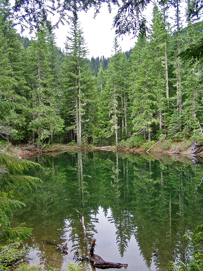
We also headed down the Motherlode trail and explored an un-named lake above the trail in a little bowl. It was in some of the burned area - bit of a rough bushwhack, but was interesting once we got up there:

It was also interesting that almost all the creek crossings were completely dry - even the Motherlode creek crossing. A couple of the crossings on Pansy Lake had a trickle in them.
The weather wasn't nearly as bad as I was expecting - I was expecting some high winds and a fair amount of rain. We had almost no rain - just a bit of misting - and most of the day it was calm. Occasionally we would get a gust of wind, but then it would calm down again.
It was interesting to see the burned area and how it is starting to recover a bit.
A beautiful corner of the district.
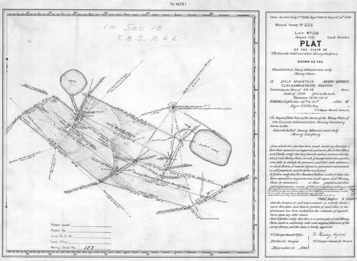
That mining claim was Bill Bagby's claim from the 1880's. It includes 2 shafts and two cuts, one of each I've found. The attached claim from the BLM shows everything except Bill Bagby's name. That I found in "Oregon Geographical Names". Note that the part of the form labeled 'Patent Issued' is blank. Test your memory against his claim that the shaft you pictured is 100 ft long. That generator was all in one piece when I last saw it. "Onan" brand.

Here is a picture of the horse pond in better, wetter times, taken 2004. I've always called this Green Lake for obvious reasons. You undoubtedly walked through or right by the old horse camp, which was on the slope just south past this, more or less straight ahead in my and your pictures. At least three decades ago the FS did a 'restoration project' on the horse camp area. The keep off signs have all fallen by now. Few plants grow beneath the trees now despite any restoration.

This basin has many secrets.
Bryon Boyce said
This basin has many secrets.
Please do tell some of those secrets. It was an interesting trip, and I love seeing history like this.
I'll start with "the old trail that used to go north to Bagby". Very few try it and it is truly a lost trail, despite being much of the way close to the current trail. It was the miners route to Bill Bagby's mines. It is becoming fainter with every passing year. It crosses the access road near the modern trailhead (a little ways west), but to the north it enters a clearcut and even 20 years ago had been rubbed out as far as I could tell. I take it to Pansy Lake almost every time I go up there. It crosses at the south end of Pansy Meadows and then parallels the current trail down to the road. Difficult to find near the road, I always find it after dropping off the current trail. Often I head for the landslide and boulder hop my way back to the old trail. It also heads uphill towards Bull from the mine shaft. Take it if you want exercise.
There is a photogenic falls on the east side of this trail with a creek that comes NW from Bull of the Woods. Access is mostly blocked by some massive blowdown.
There is a rather large landslide along the ridge to the west that created some odd conditions. The deposits are half a mile long and any water flow is now underground. There is a mixture of pumice and large blocks of ancient lava. The bottom of the valley is mostly the large blocks variety. I have found sizable chunks of quartz in the landslide mixture.
The creek below the waterfall has carried much wood and soil into what is now the meadow area. This is the only part of the landslide area with more than widely scattered vegetation, and the 'pansies' that bloom here gave the valley its name. The creek disappears here, in the alder scrub by summer but in the flowering meadows in June.
Following extremely wet winters the entire southern end fills up with water (1996 and some of the following wet winters). There is a woody debris high water mark well up the slope that includes whole trees. There is a 'main drain' where all this water eventually drains out like out the drain of a bathtub. The waters circular motion in doing so knocks last summers grassing down in a circular pattern. If you don't know there was a temporary lake here its a real head scratcher.
Further downhill there is another smaller lake that shows up following any halfway wet year. It is a lake of very pure groundwater perched on large boulders from the landslide. As you descend into the little basin the surviving lichen species become fewer until the most water tolerant is the only one left.
Bill Bagby was supposed to have made two shafts and two cuts on that hillside. I have found one of each.
Strongbox Lake is one more thing. It is named only on one old map and the name never became official. You can see it on Google or FS and other maps. Worth the short but very steep bushwhack up. One little used fire ring. Held in by a lateral moraine. I found one of the cuts on the way to this.
I tried post pictures with this but got an error about the URL being wrong.
Great write-up, Byron.
For obvious reasons, I'm intrigued by the waterfall. Id love a pic.
Do you have a photosite they're posted on?
You can always email them to Rob and he'll post em.
