
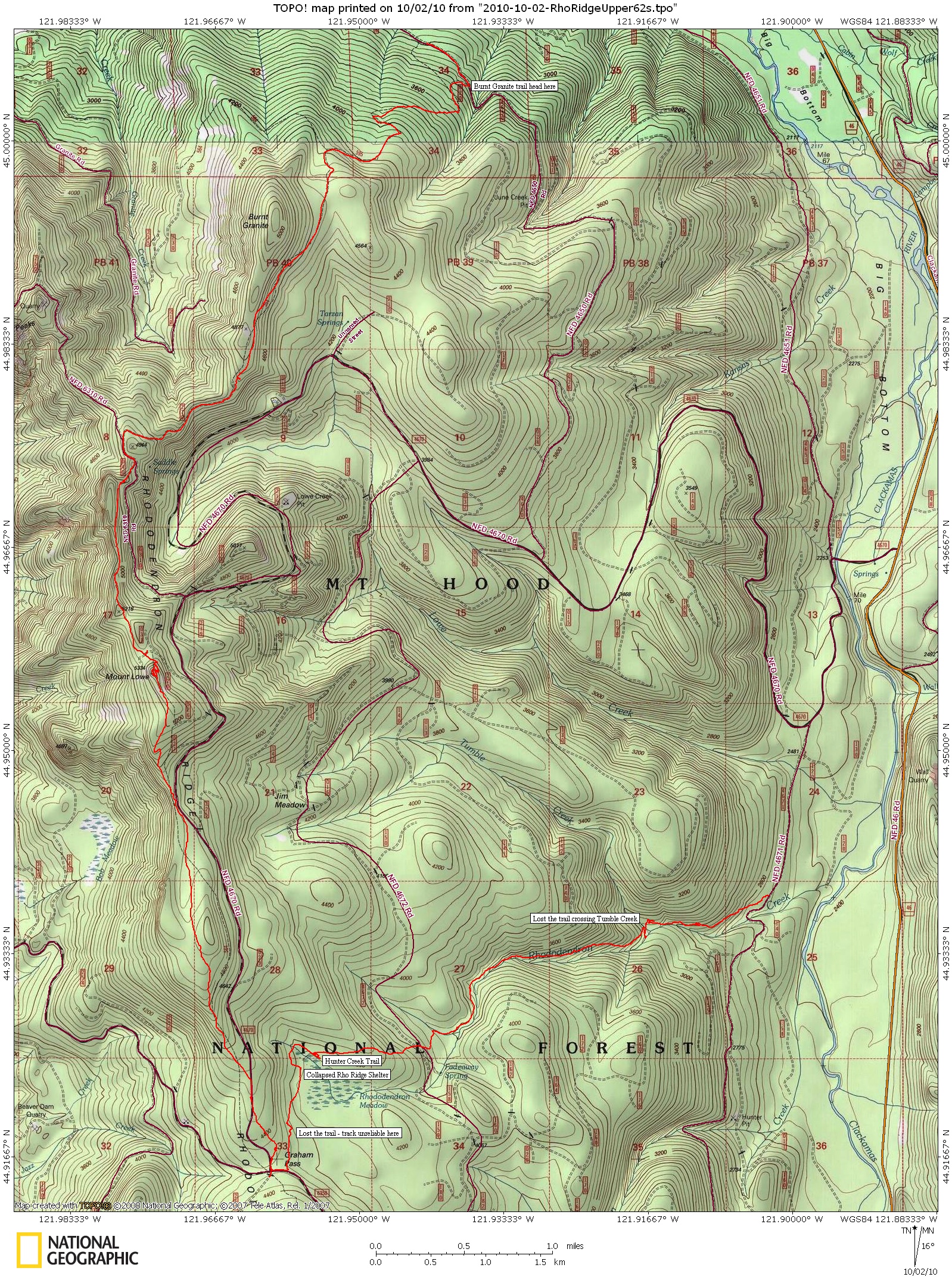
I did a bike 'n hike to cover the remaining part of the Rho Ridge traverse I started last week. The Plan was to park at the Burnt Granite northern trail head, bike down the hill to Rho Creek then hike out to complete the loop and it worked out like that. Saw lots of interesting stuff and took many pictures.
On the Rho Creek Trail. Very nice, I did lose the trail crossing Tumble Creek but picked it up again on the other side after hiking up the hill to run into the switchback there. Not sure what I did wrong.

Neat trail marker

Looks like there is something left of Hunter Creek Trail, followed it for a bit – someone has been working on it. The following is the junction with Rho Creek and Hunter Creek Trails.

I was hoping to get a good GPS track on Rho Creek for the trail guide but I lost the trail around the collapsed Rho Meadow Shelter. Some one will have to take me out there and lead me around to where the trail connects with whatever around Graham Pass.
Gimme Shelter

From there I picked up the Rho Ridge trail north of Graham Pass, nicely signed. Trekked up to Mount Lowe, great views – then north to the end of Rho Ridge Trail and on to Burnt Granite and back to the car. Here's the map. I'll send the GPX file to Rob W for inclusion for the trail guide.
Big print version is

If you walk the log at Tumble Creek, the continuation is beside you on the left side of the log. It is a poopey crossing. Especially wondering when the bark is going to let go.
It would be nice to have that hunter Creek Trail go somewhere, like, to what ever might be left of the meadow, or the creek, or a camp. Not sure out to the road would be such a good idea.
The Jim Meadow Trail was at the square hewed post leaning at a switchback.
Trail does lead south out of the guard station and runs into the clearcut near Graham Pass. If you follow the cut line west, you'll come out on the Rho Ridge Trail.
Glad you enjoyed Rho Creek. Many of us worked hard to salvage it. Needs more work, of course, but it's way better than it was.
D
Speaking of the Burnt Granite trail, does anyone have any info on the lookout that was on Burnt Granite? What type, and where it was? We were up there today and found a rocky point that had old phone line on it, but nothing else that resembled a lookout foundation. Wondering if maybe this lookout was not a permanent structure other than the phone?
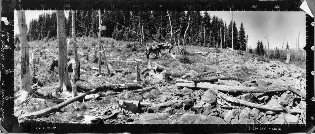
Sorry about the huge picture, but here's what was there.
Also, this might be a little lower than the "summit".
Rob, maybe you can resize the picture for folks. (edited to resize photo)
D
Donovan said:
Sorry about the huge picture, but here's what was there.
Also, this might be a little lower than the "summit".
Rob, maybe you can resize the picture for folks. (edited to resize photo)
I'm thinking that may be around the northwest side of the peak? Looking at things, I'm not sure we found the site pictured here. I'm very sure the lookout wasn't at the summit, as that was VERY wooded and I can't believe it would have grown up that much.
This page says there was a cabin there but was removed in 1950:
http://www.firelookout.com/or/burntgranite.html