
There were quad tracks (and looked like rock crawler tracks) down the spur road for sure. There was also motorcycle tracks down the real trail for a ways as well. You could see evidence of people driving through the forest as well. Way down the trail I saw a motorcycle track across the trail - looks like they went over a BIG log - they were really cross country travelling.
The good news is that the trail changes dramatically after you get down it a ways. The first part is rather depressing, but I had the same feeling this time as the last time - you go around a certain corner and all the noise and ugliness literally disappears and you feel like you are in a different place.
The trail across the river sounds like a good place to explore this fall when the river is much lower.
Rob was there any evidence of new signs that had been put up at the trailhead itself or the wilderness boundary along the 45 road? Because of the past practices in the area, shooting gallery and partying, I think it will be a while for that situation to change anytime soon.
I believe last spring I headed up there to hike the trail, but when I got to the trailhead a Forest Officer had his lights flashing on his rig and he was talking to a large group of people that looked like they had been partying and trash was everywhere. I ended up heading back down to the Clackamas and hiking up "The Sounds of Two Rivers Trail".
I have been on part of the abandoned trail segment across the river when Donavon showed it to Bob and I a couple of years ago. We came down from the road through the experimental forest to get to the old trail and followed it down about halfway, but we never came all the way down to the river. There is some nice old growth in there that is now wilderness.
Don
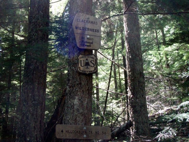
No new signs at the trailhead, but as you make your way down the trail, there are nice new signs with the trail name and number and the wilderness sign. If I remember right, this is still on the old spur road, almost to where the actual trail starts:
I'm thinking I'd like to take this trail down to the river, cross and then up the other side in the fall sometime (when the river is low). There may be several options to cross without getting soaked….Since the tral down to the river is only about a mile and a half, it would be pretty easy to hike up the other side a ways.