BrianEdwards said
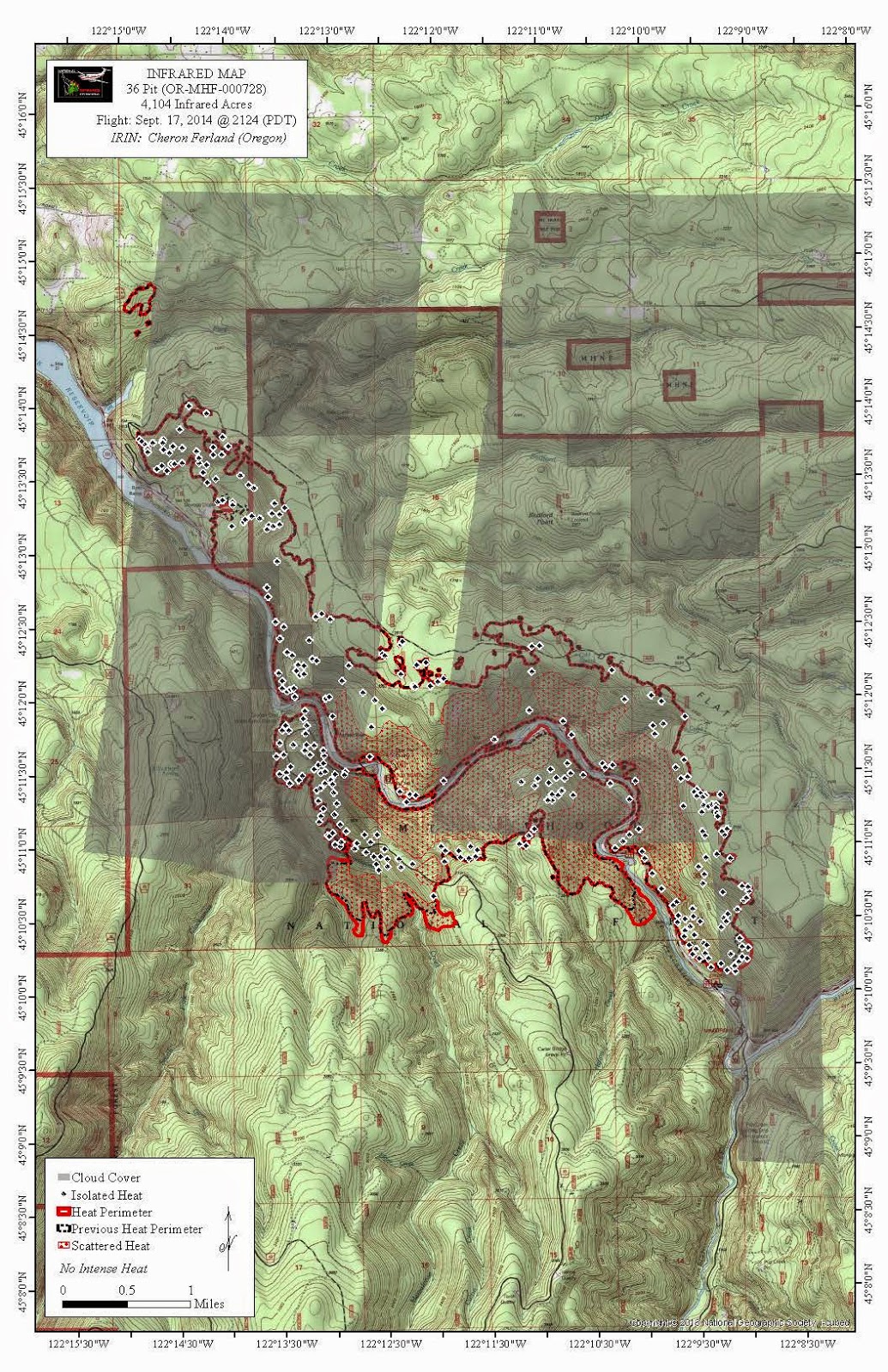
Looks like the old bridge over the south fork is right at the edge of the burn. Really hoping it survived. The sign on the Christian camp trail also looks to have survived. Gonna be very wierd seeing all the burnt hills.
The map today shows it right at the confluence. I kind of doubt that bridge will survive, since I'm sure the fire will grow more. That is such a shame. At least I'm glad I got to see it before it got consumed. It is going to be VERY weird once we can get back in there.
Here's this mornings fire map. It looks like it's dieing down. Just a little growth on the south edge.

Donald Presley said
Update on the 4610.220 road! Luckily I found my Zigzag district map that shows the 4610.220 road just to the north of High Rock. Our district map has the map legend box on that spot of the map. So that tells me the FS shutdown the upper access to the Roaring River Wilderness. So no Hambone or Frazier Turnaround access, is that what I'm seeing? If I was the district ranger, I probably would have done the same thing until they get control of this fire. It's not over yet folks!
It's interesting that the road conditions page has this closure listed. That road isn't mentioned in the official closure notice released on 9/14.
http://www.fs.usda.gov/Internet/FSE_DOCUMENTS/stelprd3816842.pdf
Hopefully the rain is reaching the fire and is helping a bit as well. I guess the rain and humidity are a double edged sword - it helps reduce the fire, but it means they can't set backfires (to create fire breaks).
This morning's map is good news. Hopefully that will continue.
The rain today should help.
Also, the drive up the beginning of Road 45 is gonna be radically different with no trees blocking the view from the cliffy perch.
