Here's a link to a short video from the cab of a state highway truck as they're driving 224 through the fire area.
Wow - that video was really interesting! Parts didn't look as bad as I thought they might though - there is still green amongst the burned areas. Not sure exactly where he was driving, though. Hopefully the weather will cooperate in the coming days and they will start to get a handle on it.
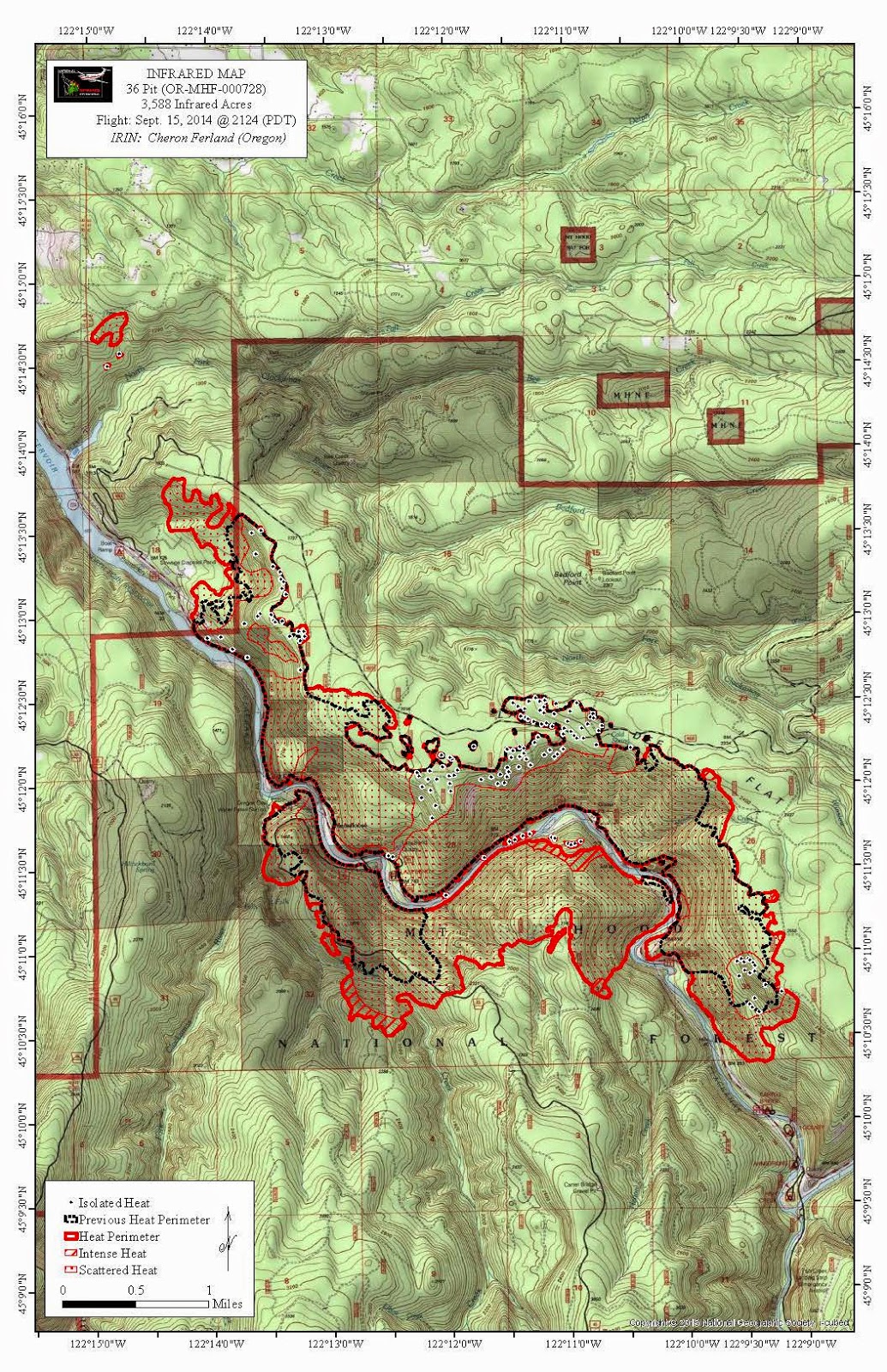
Here's an updated infrared map. I think it was generated from an airplane flight last night. It looks like the fire grew a bit yesterday. The humidity seems a lot higher this morning. Hopefully that will slow it down. Plus all the additional firefighting resources being brought online.

The inciweb update this morning said it was pretty quiet last night due to the increased humidity. They only showed it increasing 58 acres last night. Hopefully that trend will continue, with minimal expansion.
Rob Williams said
...it was pretty quiet last night due to the increased humidity. They only showed it increasing 58 acres last night.
You spoke before all the new reports went up. The map kirk posted near the same time as you has the detail - its now at 3588 'infrared acres', a gain of 1233 acres in the 19 1/2 hours between the two maps. The map shows yesterday's boundaries at 3 AM and last nights at 9:24 PM The scary part is is the growth towards Estacada. The boundary for the main area enlarged half a mile NW towards Estacada downstream. A sizable spot fire is another mile NW. With earlier fire spread, Estacada is now 5 1/2 miles from the fire. The news articles are still using the phrase "started ten miles SE of Estacada" which does not give the current situation. With all this the biggest area of fire growth is south of the river! And the fire is still "0 percent contained". There are 4 campgrounds within a mile of the upstream edge of the fire.
Hopefully the changes in weather will slow fire growth and prevent crowning. If so there will be some containment especially above along Dee Flats. Steep areas along the river will be difficult. If the fire stays on the ground the overall effect will be forest thinning with the larger Doug firs the main survivors.
