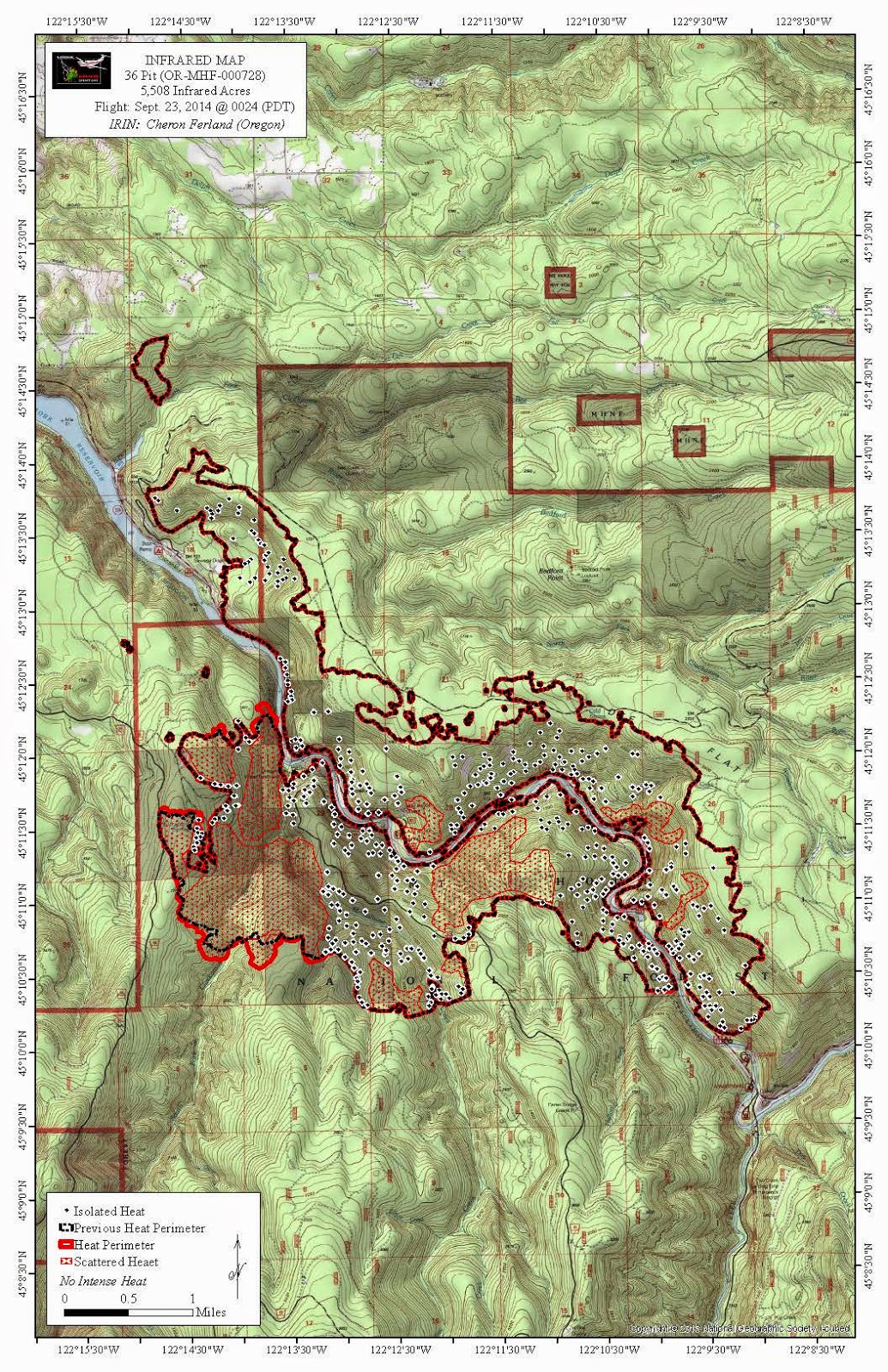
That is weird - when I posted it I could see the photo - they must have some sort of "anti leeching" code active. Anyway, I posted the link to the photo - it came from the inciweb site.
Thanks for the idea. It just looked really weird (and bad).
The spot fire was just behind the place I used to live up on Fall Creek Rd. Close to 40110 SE Fall Cr. Rd. That area was logged a couple years ago. It is pretty far from the NF but not terribly far from Bee Cr. I think they could see the flames from the house before they evacuated.
And just as a sidenote, I think there is a decent chance that Lazy Bend Campground is still there. There are large pockets of unburned area in the ODOT vid and one of them appears to be about Lazy Bend. Hard to tell.
Rockfall on the road is going to be one of the more interesting aspects of the fire once they open the road but I think they will get that sorted out fairly quickly and re-open the road.
I've been trying for years to get that quarry closed to shooting. Hopefully that is the good part that comes out of this. I hadn't realized there was an old trail at Moore Cr. Where did it start?
Here's today's map. Hopefully this will be the last one to show any growth.

Pete Giordano397072624 said
I've been trying for years to get that quarry closed to shooting. Hopefully that is the good part that comes out of this. I hadn't realized there was an old trail at Moore Cr. Where did it start?
I agree, we don't need a shooting gallery along 224 and the Clackamas River in general, considering the amount of recreational use in the area.
The old trail up Moore Creek shows up on the '38 map as well as others and went up to a campground on La Dee Flat. I found the bottom segment several years ago above the power line right of way. There were a couple of switchbacks before going into an old clearcut with roads and logging pretty much wiping out the middle section. I picked the tread up again above the clearcut closer to the top. With the shooting going on below in the quarry I decided to get out of there. On a return visit coming up Moore Creek , I ran into a marijuana grow site near the creek with tents and a drip irrigation system to water the plants. Feeling uncomfortable I left and reported the site to the FS. I hadn't been back since.
Hey do you guys know if you can get to 4614 to the upper Fanton TH? Fall Creek Rd is about 1/2 way up the big climb before the drop into Promontory.
EDIT: no, the whole area is still closed:
http://www.fs.usda.gov/Internet/FSE_DOCUMENTS/stelprd3816842.pdf
Maybe the rain will change the closure anyway.
