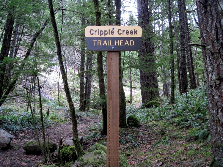
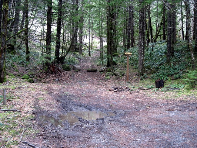
I hiked part of the Cripple Creek trail yesterday, starting at the trailhead on Pipeline Road. When I was done, I decided to drive farther south on Pipeline Road to see where it would take me. Just past the Cripple Creek bridge I came across a sign for the Cripple Creek trailhead.
This was a surprise to me, as I had just come from the Cripple Creek trailhead up by the pipeline. I explored the area around this new sign and found no indication of any trail, just the abandoned access road for the pipeline. Does anyone know what this is all about? It's a mystery to me. Surely the FS doesn't expect people to park here and hike back along the road to the actual trailhead.
I must say, it's a very nice sign, brand new, flawlessly installed on a beautiful, thick, straight and perfectly plumbed post. It's a thing of beauty, really. The parking area has room for two or three vehicles and a fire ring in case you need that. The only thing that seems to be missing is a trail.
Doug
A lot of new signs went up last year from what I have seen, probably some of that stimulus money that swept through the FS recently. That doesn't mean that the person installing the new signage even hiked that particular trail, which was probably the case here.
I missed that one at Cripple Creek for I usually turn around at the trailhead by the pipeline and head back to Three Lynx instead of going further up the pipeline road. There was a new post with a trail number at the correct trailhead when I hiked the trail the last time a few months ago in the snow with Rob and Kirk, but it wasn't an official "Trailhead" sign like the photo you posted. We parked down on Hwy 224 at the bridge at Indian Henry and hiked that abandoned segment up to the pipeline trailhead and on up the trail.
I even saw a new sign at the Rho Creek Trailhead on the 4671 road last fall and it was an officail trailhead sign like the one at Cripple Creek. At least it was put in the right place. The funny thing about Rho Creek, everytime we marked the trailhead with a temporary paper sign or even flagging, someone removes it and disguises the trail with logs and such. I wonder how long that sign will last, if it is even still there.
Don
Interesting.....A beautiful new sign in the wrong spot. That certainly is a nice sign!
And Don, I had the same experience on Rho Creek. I made a rock cairn near the trailhead, since I had a hard time finding it the first time. Next time I went by, it was gone. Funny, since it re-appeared on the FS website after it was recovered.
I think there is some old inaccurate info that indicates a route there. When I first went looking for the trail, that was where I started. Then I went up the ramp beside the pipe that PGE graveled. Indeed they had restored the beginning of the route to get up to the "ditch" grade, at which point they doubled back to 3 links creek. The surveyors were studying the site for a mini hydro. The ramp was so steep, we cleared out the switch back at the current start off the road which had been lost to time as had the rest of the trail above.
I suppose someone should put a sign on the sign pointing up the road. Or just wait. The sign will be gone by the end of the season.
It is kind of a shame.
D
