Notifications
Clear all
Jan 26, 2010 5:42 am
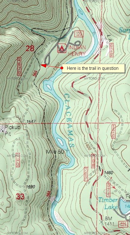
So I was just looking at the current map and the '38 map, looking around Alder Flat, and when browsing around the current map, I found a trail going south from Indian Henry down tothe Umpqua quarry? (across the river from the Raab campground). The map shows it as trail 564, but that can't be right since that is the Rho Ridge trail. This trail does show as a pretty long trail though
Is this a map error or is there really a trail down that side of the river?
Here is a map fragment:

2 Replies
Jan 26, 2010 8:59 am
Rob,
I had the same question about a year or so ago and Donovan cleared it up for me. Here is the link: /discuss/msgReader.1010.html
Doug
Jan 26, 2010 11:28 am
Thanks for the info Doug. I don't know how I missed it. Too bad, though. That looks like a pretty cool route for a trail!
