
Last Sunday I decided to look for another abandoned trail that I have been wanting to checkout for sometime, but hadn't made the time to do so. With the snow level hovering around 2500 feet, I thought that now would be a good time , for the trail starts out around 1500 feet. This old trail came over the hill from Austin Meadows to go around the cliffs that are prevalent below Austin Hot Springs and came down Switch Creek to reach the Clackamas River just below the springs. This portion of the '38 map shows the area I am talking about.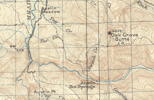
There was an old road or campsite just past Switch Creek, so I pulled off the road there and parked. Not knowing where to start to look for the trail I hiked up a faint spur road to the right that headed straight up. I didn't see anything here, but I knew the trail had to cross the creek somewhere so when I reach the creek and crossed over to the otherside, I continued going up the creek.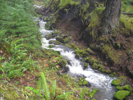
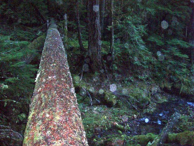
I passed to the right of a large flat faced rock outcropping on the westside of the creek and started to climb up the hill to a prominent ridge that parallels the creek. When I reached the top of the ridge, I stumbled onto the trail coming down the crest of the ridge. I must have missed seeing the trail lower down, but I figured I would look for it on my way back down. The trail was fairly easy to follow as it stayed on the crest for the most part, with faint blazes in the trees if you looked for them.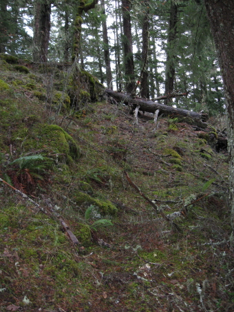 This picture shows the area where I came out on the trail just above that log across the tread. I hiked to snowline, which was somewhere between 2000- 2500 feet and it was snowing like crazy, so I turned around to checkout the lower section I had missed on the way up.
 There were alot of switchbacks coming down, but the tread looked like it was in good shape, just a lack of maintenance in the last 50 years or so.
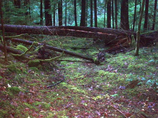
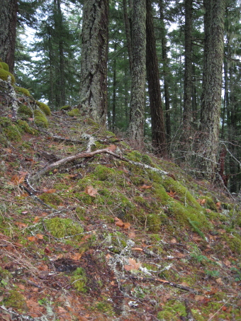 There was a section line marker on a tree next to the trail, giving you a positive location; T.6 S.,R.6 E, sec 24/25.
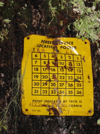 A little ways past that marker the trails turns torwards the creek and comes out at that flat faced rock outcropping I had past by on my way up the creek. I had just missed the trail by 10 feet earlier in the day. There were several large logs across the trail between that rock and the ridge, but I flagged it to make it easier to follow.
I couldn't locate anything on the otherside of the creek on my way back to my rig but that spur road. It may have erased that section of trail. If you want to checkout this old trail, follow the old spur road on the right at the pulloff up to the creek , crossover and head up to that rock outcrop on the westside of the creek. Just turn left at the rock and follow the flagging.
I for one will return to checkout where the trail comes out on top and look for that junction with the old Oak Grove Butte Lookout trail.
Donald, glad you found this old trial. I have not been in this area but will put it on my list.
I am interested in you '38 topo map and any other old maps that are out there. Would it be posible to enlarge the maps section with our old maps? Scanning large sheets is a problem and I am not sure how much space there is for storage here but I would guess there would be interest in haveing a place for these historical maps that we could all share.
Bill
Bill
I got lucky and stumbled upon that trail last Sunday. I am planning on going back up there this Sunday to revisit it along with others who want to go and check it out. A time hasn't been set, but we will probably meet at the Estacada Ranger Station and carpool from there.
That '38 map of the Mt Hood Nat'l Forest I purchased on ebay a year or two ago for $26. I have tried to find a business that would be able to scan the 39" X40" map, but haven't found anybody so far. I have scanned most of our district in six 8 1/2 X 11" scans and put them on a disc, using a high resolution so that it blows up good. I would like to get the map in it's entirety on our website, for it is such a beautiful one with its sepia contours and blue waters. I don't know how many of old forest maps were in color, but I have only see two, the '38 and '46.
We have found a few errors on the map; some trails that do not exist, drainages that are wrong, trails in the wrong places. Even with it's faults, it is the map I keep coming back to explore out it's trails. Even with it's 1/2 " to a mile scale, it has more detail per inch than our present map. It is a trail map, for there weren't many roads back then. The more modern maps the FS put out are mostly road maps, with a few of our trails put on them. I would say that probably half of the trails still out there in our district aren't on the latest edition of our district map.
Bill Cattrall said:
I am interested in you '38 topo map and any other old maps that are out there. Would it be posible to enlarge the maps section with our old maps? Scanning large sheets is a problem and I am not sure how much space there is for storage here but I would guess there would be interest in haveing a place for these historical maps that we could all share.
Bill
I'm not sure where Don got his map but I've got a whole bunch of old map pictures (not scans) from maps from the UofO library. Paul Turner spent a day down in the library taking the photos of the maps. They aren't quite as good as a scan, but most of the photos are really good. The only bad thing is trying to find the photo you need for the section of map you are looking for. Once I get something put together, I'll post a note. It is going to be a winter time project for me to get them put up.
Rob
Well, Don and I went up to hunt down more of this trail last Sunday. According to Don, a lot of snow had melted, and we only saw a tiny bit up on top at about 2800'. What a beautiful day it was! We found the upper part of the trail, and found the connector to the trail up to Oak Grove Butte Lookout. We saw several old insulators on the trees: 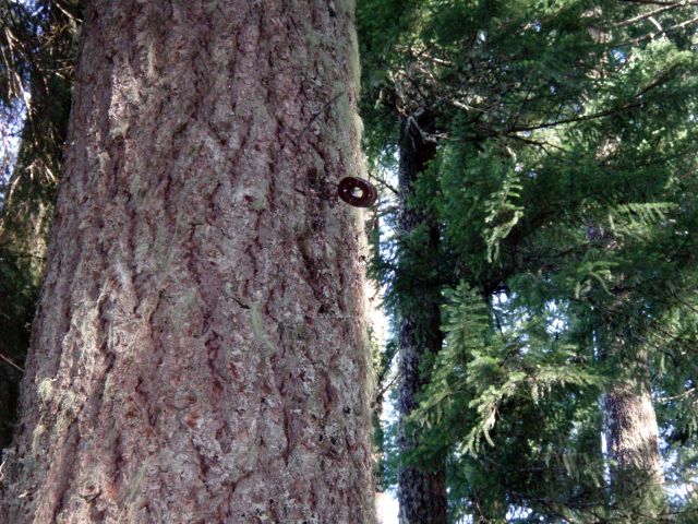
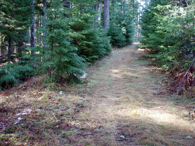
We got to the top of the trail where it met an old cat road off the 4640 road:
Here is the creek crossing near the large rock outcropping that Don talked about:
And here is the old cat road that seems to have obliterated the beginning of the trail:
My apologies for the darkness of some of the pictures. I took them on the way down, and it was starting to get a little dark in the woods. We spent a little time cleaning off some of the trail, and doing some brush work. It is amazing how well preserved some sections of that trail are. There are a few faint sections, but a lot of it is still in really good shape. A couple days of work and it could be a really great trail. The lower section of trail is amazing – the ground feels like you are walking on a sponge there is so much moss and greenery. The other thing about the trail is that even though it gains a fair amount of elevation, most of it isn't too steep. There are a couple spots where you get some nice views through the trees, but we didn't see any really good overlooks. One thing I didn't see was the section marker that Don showed above.
It is a beautiful trail, and I really enjoyed hiking a bit of history. I want to return and find more of the trail…..
Thanks, Don!