
How strange to see this thread! I have been out of ciculation for a while after quitting a horrible job and starting a guide and outfitting service, but I still have been doing trail work, camping and research. Well last week I decided to research Pot Creek and figure out what remained. Then I log on here, and see THE SAME work done by you guys. Go figure.
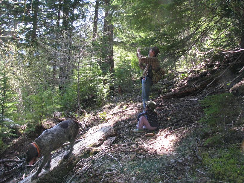
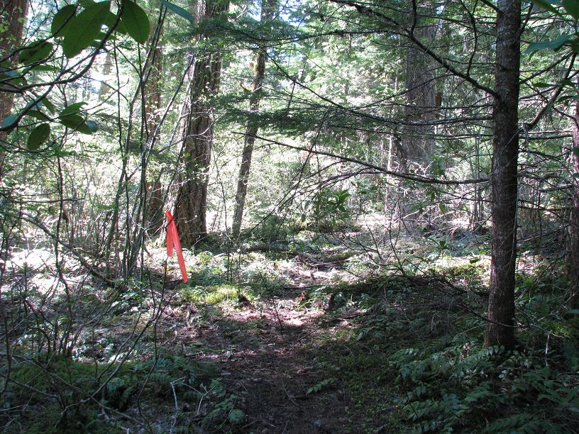
Well Don and Eva and I headed out to Pot Creek last weekend to camp and explore. After much thrashing about, we found trail from the cabin site all the way up thru the clearcut above, switchbacking its way thru the mess and beauty. It is flagged all the way to where Don was previously. The tread is in fair condition, but it is remarkable to have survived clearcuts and time. Don brushed out the lower portion, but I had to split at 7 AM on Sunday due to a puking child. Fun in the woods!
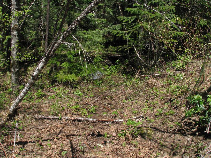
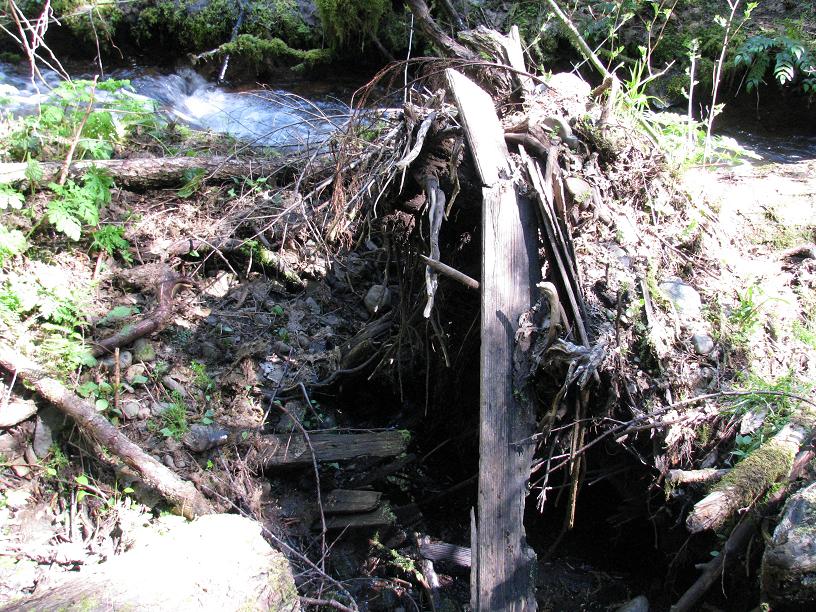
We pretty much determined the location of the cabin, now only a square depression near Pot Creek where the original trail descended, as evidenced by the remains of a bridge and iron water pipe.
It's a trail with potential: good views, well graded, nice origin with camp. However, it needs a destination. Oak Grove Butte?
Robert Koscik said:
How strange to see this thread! I have been out of ciculation for a while after quitting a horrible job and starting a guide and outfitting service, but I still have been doing trail work, camping and research. Well last week I decided to research Pot Creek and figure out what remained. Then I log on here, and see THE SAME work done by you guys. Go figure.
Well Don and Eva and I headed out to Pot Creek last weekend to camp and explore. After much thrashing about, we found trail from the cabin site all the way up thru the clearcut above, switchbacking its way thru the mess and beauty. It is flagged all the way to where Don was previously. The tread is in fair condition, but it is remarkable to have survived clearcuts and time. Don brushed out the lower portion, but I had to split at 7 AM on Sunday due to a puking child. Fun in the woods!
We pretty much determined the location of the cabin, now only a square depression near Pot Creek where the original trail descended, as evidenced by the remains of a bridge and iron water pipe.
It's a trail with potential: good views, well graded, nice origin with camp. However, it needs a destination. Oak Grove Butte?
[...]
Fantastic work you guys have done, I'll have to get back out there and check it out. Your efforts are appreciated. As far as a destination, Oak Grove Butte works but I can't see anything but a road walk once on that plateau from the maps I'm looking at - at least there is trail at either end. I'm going to take a stab at Oak Grove Butte this coming weekend provided the snow levels are high enough.
--Paul
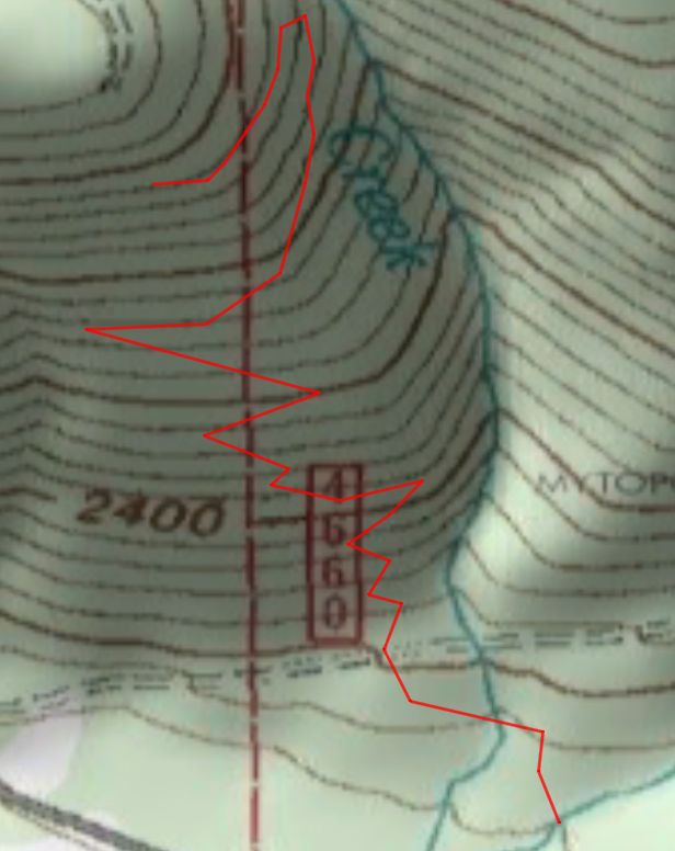
A little clarification on the posting for the Pot Creek Trail:
There is a 200 yards plus gap between the lower leg of the upper switchback and the upper leg of the lower switchback. Either the trail swings further to the west out into the clearcut, or there is a switchback between the two located switchbacks that I haven't located yet.
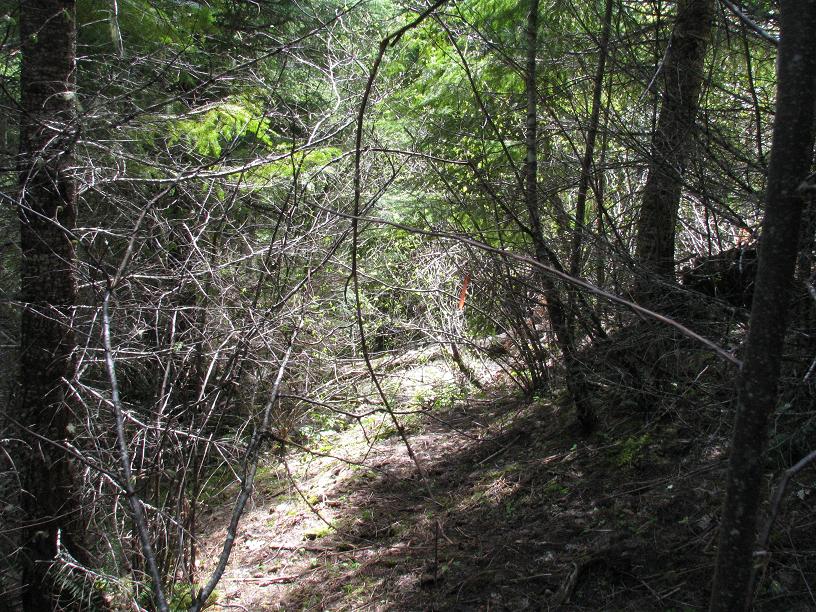
Paul, if you were to head straight down the edge of the clearcut from the upper switchback, you would run into the lower one. The upper trail segment is fairly easy to follow as well as being flagged, but hasn't been touched. The lower switchback is cleared of most of the brush, but there are numerous logs to step or climb over. Where the trail comes out into the clearcut below the lower switchback there are a lot of logs and the path of the trail is less distinct because of the logging disturbance.
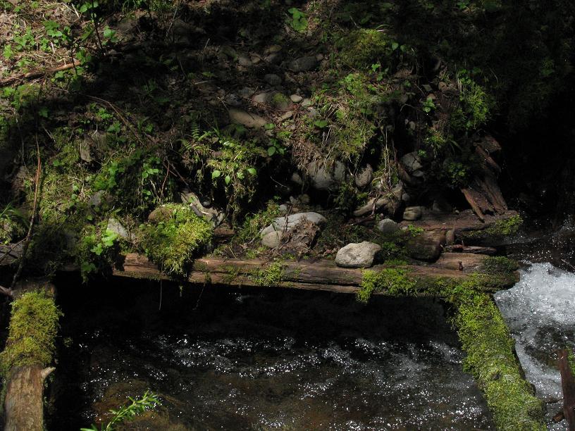
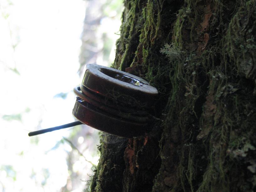
The trail comes out on the 4660 road a few hundred feet below the Lost Creek crossing near a pullout that is on the southside of the road. The trail continues below the pullout, but isn't readily obvious until you step off the berm of the road. I cleared that section down to Lost Creek. There is one insulator on a tree in this section. The trail between Lost Creek and Pot Creek isn't recognizable that I could tell, probably do to creeks overflowing or changing course through the years. There is part of a footbridge on Pot Creek that is covered with at least a foot of gravel. Once you cross Pot Creek you arrive at the Pot Creek Cabin site with numerous large trees and seems to be a popular camping spot. Following the dirt road will take you out to the 46 road.
Don
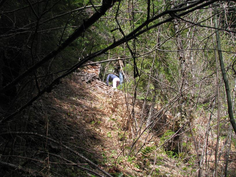
More info from Don's exploration yesterday (I just tagged along to help do some brushing and see the trail). I brought my GPS, but since we spent a lot of time brushing out the upper parts of the trail, there is a lot of "jitter" that throwns off the total mileage.
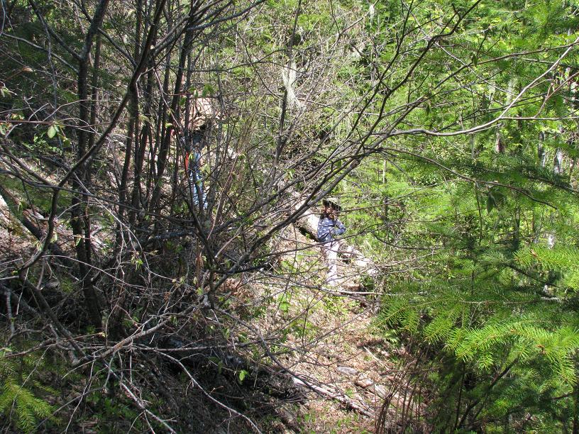
As Don said, parts of the trail are very easy to follow, but there are a lot of places through the clearcut that are difficult. You can see we took different paths up and down, and a lot of it looks like it "could" be tread, but is probably more game trails than anything. There are a few sections in the clearcut that definitely looked like tread, but a lot of it is rather indecipherable. I think at some point you just have to pick a route, brush it out and then walk it a few times to make it clear and it will be fine. It will just take some work.
The upper section, while the trail was very noticable, there are a LOT of logs to go over/around/under. One spot has an 8'+ deep hole from a root ball you have to navigate through.
So, now for some pictures:
Here is the trail track we took, overlaid on an aerial photo (shows where the clearcut is) – on the way down I marked where we felt comfortable that we were "on the trail" and then when we felt we had lost it:
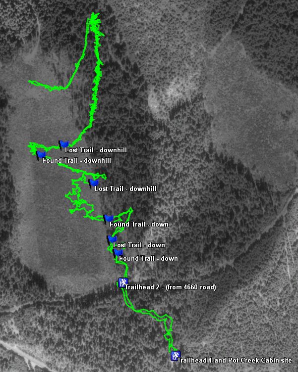
Here is what I think the actual route of the trail is probably (or should be):
And lastly, here is our actual trail track overlaid with what I think the real route of the trail is.:
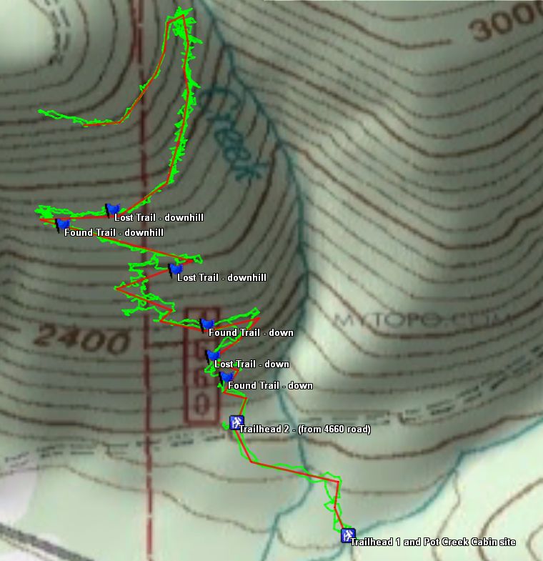
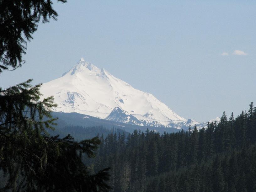
The bottom line is that there appears to be a little over a mile of trail discovered here, probably a mile and half or so, maybe a little more, but of that, about a quarter of a mile or so is very indistinct and needs more work to create a suitable path. A lot of the upper section REALLY needs to be cut out to be passable, as it is pretty rough right now. That upper section is a nice section of trail, with some really nice trees. A couple of nice viewpoints, too.
I think it deserves some more work, and it might turn into a really nice trail.
Rob, thanks for the posting of our GPS track from yesterday on the Pot Creek Trail, it really helps to visualize where the path of the trail out in the clearcut ought to be. A lot more work still needs to be done locating the tread out in the clearcut, but we added more footage yesterday. A little here, a little there, and pretty soon we will have most if not all of it located. There are going to be gaps from the logging disturbance, but as long as we can connect the segments together we may eventually be able to bring the trail back from oblivion.
Don