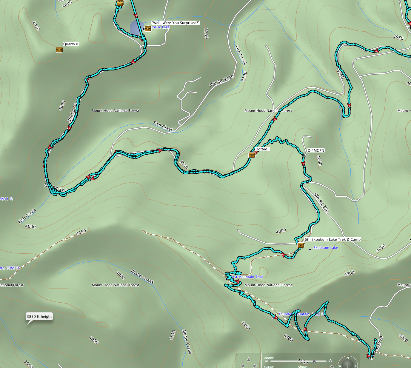
Here is our track it is a partial. We started at Fish Mountain and went to Surprise lake. From there we went to Skookum and out over Thunder Mountain. The geocaches can be searched for on.geocacheing.com. With the exception of the "Dotted I" trail the rest was on the old road bed.
Paul_D_K said
UnderwaterArsonist said
Sounds intriguing. I would love to see a track of it as it seems like it would inherently involve navigating heavy alders and other brush, plus numerous harvested areas. In other words just about as crude as trails get. In my historic map digging I don't think I came across a route that seemed to even approach Surprise Lake, let alone go between the two lakes.And that's a large part of my attraction to the area, it's more than just walking some mindless trail that's guaranteed to get you from point A to point B. You have to actually use a map to figure out where you're at and what might be the best way to get there.
Thanks for the track! And I agree, that's the main appeal of the area, which also basically guarantees you solitude.
Although I'm still pretty inexperienced in off trailing it's always something I'd like to do more of.
I was hoping to try and make it in to Surprise Lake via the Baty Butte trail, but was planning on going a bit of a different of a route to shave off more mileage. I wonder if it'd be worth it to bail off before Skookum Lake on a short logging spur (390) and descend from there. It looks like it'd save around 2 miles compared to taking the other way. Maps also show another logging road (048) intersecting closely below it, though from what I can discern it looks much more overgrown then the top spur. MS paint skills aside, hopefully somebody will have something to input about my rough plan. 
I've been up that way this year and earlier and there is a few things that may help depending on your goal.
There is an unmarked trailhead on BLM land at around 4400' ft. that is the easiest way in with the least amount of climbing. It very quickly reaches the Boundary Trail. A 2 mile trail is easy all the way to the old road 350 at a point SW of Baty Butte. Depending on the exact route to Surprise Lake chosen it may also be a shorter way in. This trailhead is reached by driving up the Molalla.
If the immediate goal would be Skookum Lake or Thunder Mountain, you need to find either the long abandoned old trail (the shortest and most direct) or a recent longer way-trail pioneered by unknown folks who were not aware of the old trail. The old trail, which starts down the former sideroad 370 to the southeast, is hard to find as a pile of 3 and 4 ft. thick blowdown trees is hiding it. The recent way-trail is starts near the end of 370. The main road is a third route but is getting choked with alder and brush where it's on the north slope but it still can be followed.
If you study the map, you could (brush permitting) descend the uppermost reaches of Fish Creek near Baty Butte once you reach the old road, and reach the road to Surprise in about half a mile. Using the scale, it looks like about 2500 straight-line ft. from the old road near Baty Butte to the next old road at a point about 1.1 straight-line miles from Surprise Lake. Total distance would be in the neighborhood of four miles adjusting for twists and turns along the route. The turnoff point I would try from the old road is near the lower left edge of the track map sent in by Irishharmon.
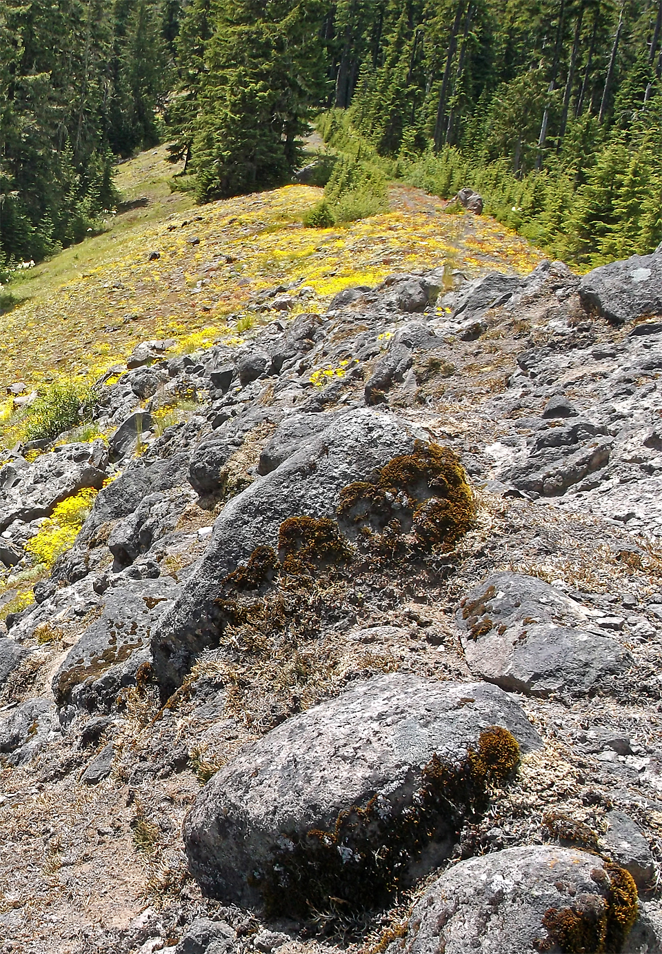
The 4th of July 2014 picture below shows the current condition of obliterated Road 350 on the right along the small evergreens. The jump off point for Surprise would be the gray patch in the upper center of the pix or a little past it behind the trees. The slopes of Baty Butte are above the gravel patch on the right. To the left the old road drops quickly on the Blister Creek side. If you come from the BLM trailhead, you would jump off of old Road 350 quickly after reaching it by the Baty Butte Trail. You will be in old growth quickly once off the road though the first 20 or so feet is thick with seedling firs and hemlocks.
If anyone wants to try this before the snow flies, let me know.
UnderwaterArsonist said
Although I'm still pretty inexperienced in off trailing it's always something I'd like to do more of.
I was hoping to try and make it in to Surprise Lake via the Baty Butte trail, but was planning on going a bit of a different of a route to shave off more mileage. I wonder if it'd be worth it to bail off before Skookum Lake on a short logging spur (390) and descend from there. It looks like it'd save around 2 miles compared to taking the other way. Maps also show another logging road (048) intersecting closely below it, though from what I can discern it looks much more overgrown then the top spur. MS paint skills aside, hopefully somebody will have something to input about my rough plan.
This is a route suggested by Twigmister, a fellow geocacher from Molalla and I was going to look at it if I had time in the future. for now I've been going in from the Clackamas side. Although that may change with the current Forest fire.
Bryon Boyce said
There is an unmarked trailhead on BLM land at around 4400' ft. that is the easiest way in with the least amount of climbing. It very quickly reaches the Boundary Trail. A 2 mile tril is easy all the way to the old road 350 at a point SW of Baty Butte. Depending on the exact route to Surprise Lake chosen it may also be a shorter way in. This trailhead is reached by driving up the Molalla.
I would be interested in this route, do you have GPS coordinates for it or a map showing the location
