Sunday I and a good friend started from the Lost Creek Meadows trailhead over the side of Baty Butte and onto Skookum Lake via the obliterated road and back on the old South Fork Trail.
We took time to investigate what may have been the long lost Camelsback Way. Some distance before the junction with the now obliterated 350 road, we found a clear series of blazes on the trees. Little is visible from the trail, but they were north of the trail close to where the vegetation along the trail opens up as noted in the Undated Trail Log available on this site. That trail also mentions Camelsback Way at approximately this location.
If you try this, pick a dry day. There are some small benches the trail follows at first, but then its steep hillside. Judging from Google Earth, its half a mile to the next obliterated road, which will take you to Surprise Lake. The tread we found was very vague, with needle and ash fall, limbs and tree trunks, not to mention soil creep on the steep slope making recognizing tread difficult. The undergrowth where we were was open and not an obstacle. Not far downhill to the east were springs and shrub thickets.
Conditions were wet and footing was slippery. We thought the better of the endeavor after a few near falls and falls. The last blaze we found indicated a sharp bend in the trail. These all are the double blazes - a short upper mark and a longer lower one made in the direction of the trail. One showed two times the ax cut directly deeply into the tree, with the bark between then peeled. There is no way these are accidental marks.
We did establish that long ago there was a well-blazed trail decades ago. It heads out Camelsback Ridge near the elevation of Surprise Lake.
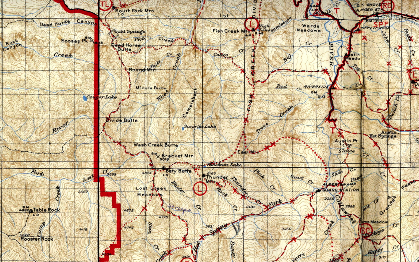
The 1946 Firemans map of the area clearly shows a minor trail from Bracket Mountain to a overlook above Surprise Lake. It does not show it continuing past that overlook.
Last July I packed in from the Lost Creek Meadows trailhead and then over Bracket Mtn. This was a short trip reaching Surprise Lake early afternoon, but not for the average hiker. I would be interested in the 1946 Firemans map, do you have a like. I leave today on a trek following fish creek from the Clackamas River to Surprise and then on to Skookum, then out on Sunday over Thunder Mtn. Going to be a fun five days. Mainly I enjoy exploring this area and all the points that I can access it from.
Ahoulda attached this already - this is just a scanned snippet and the original covers a lot of ground. I will be trying get more of this. This came to me as a pdf which this site would not accept so I had to convert it to something it does.
Byron, thx for sharing.
So what I'm gathering from these posts, part of the Camelsback trail is still followable? Im quite interested in more info, location. I did check out the attached map.
Surprise Lake could really use a better way to it than the crazy bushwacks required currently.
-B
Bryon Boyce said
This came to me as a pdf which this site would not accept ...
Bryon, if you send it to webmaster@trailadvocate.org I can post it here. I may see if I can enable .pdf files for upload as well on the forum. I'll have to investigate how to do that.
That map is very interesting.
