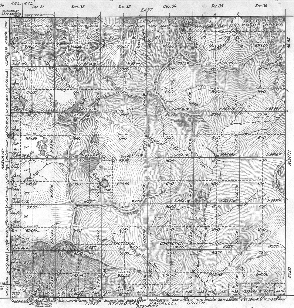
I believe this trail is in the earliest land office maps.
Here 'tis.
The trail in question on this 1922 survey map deadends at what is shown as two small lakes, and does not continue south towards the then-future Lake Harriet. There is no Rimrock Trail either.
Their is a nice complex of trails shown to the north which this trail connects with, including Indian Ridge. No trails shown in the Rock Creek Basin - they were built several years later.

Bryon Boyce said
Here 'tis.
The trail in question on this 1922 survey map deadends at what is shown as two small lakes
It looks like the "two small lakes" is Cottonwood Meadows. I guess the meadows hadn't been named yet.
Bryon Boyce said
No trails shown in the Rock Creek Basin - they were built several years later.
Which leads me to a question that came up a few days ago - is anyone aware of any kind of reference that lists when a given trail was constructed? And further, what was the purpose of the trail? I have yet to encounter anything like that but it would be hugely interesting.
The only way I know of to "know" when a trail was built is to look at old maps and see when it appears on the maps. But this isn't a very good way either - since trails like the 511 were built in the early 30's (according the Alton Everest book), but it does not show up on the '38 map.
I figured the trail had some trapping/root digging legacy. Perhaps running sheep. There's not much food in the woods so these series of openings would have had value.
Generally I find trail dating mostly has to do with work. In the burned out areas, tree planting and protecting the plantings. That was the driver for the Roaring drainage trails apart from travelling the divides. Prior to that the early Reserve efforts to establish control. The perimeter and tower trails.
Interesting to me it seems Hideaway lake was already claimed or applied for perhaps by the Sportsman's Club?
Don 2
