
Last Sunday I continued work on another lost trail project I have been trying to locate the past year or so when I am not clearing trails, the old Bagby Trail from Austin Point. There are several sections of this trail between Austin Point and Bagby Hot Springs that still exist, albeit the trail maintenance ended about the time the roads were punched in. Miles of this trail were lost to roads and logging, but other sections survived.
The section I am trying to locate starts near Austin Point off the 6310 road and goes south to where it crosses the Collawash at Little Fan. I located a portion of this trail last month and wanted to see if I could push my flagging out a little further. I had ended in a logged area and wasn't able to find any tread going into the uncut forest when I quit last month.
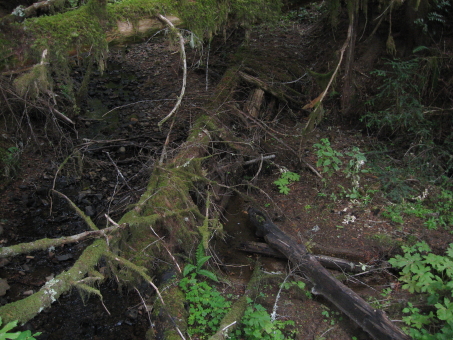
I found my flagging easy enough and followed it to edge of the cut. I was walking on what looked like a skid trail from the logging and a log was laying lengthwise in the trail, so I climbed onto the log and walked it's length and jumped off the other end and realized that there was only one track. This wasn't a skid trail anymore , it was the trail. It went over a small ridge then dropped into a small ravine crossed sides and came over another rise before turning sharply to the left and dropped into another steeper ravine with water in the bottom of it. I had just entered into the area known for slides, and I would see alot of it before the day was done.
The tread had sloughed off the side of the ravine from what I could tell. There was a cut log there so I knew I was on tread. I was able to crossover on a log that spanned the stagnant water. The trail continued for 100 feet or so and came to a creek. Looking upstream I saw an old footbridge, maybe 30 feet long laying in Cap creek.
Here is another picture of the footbridge upclose.
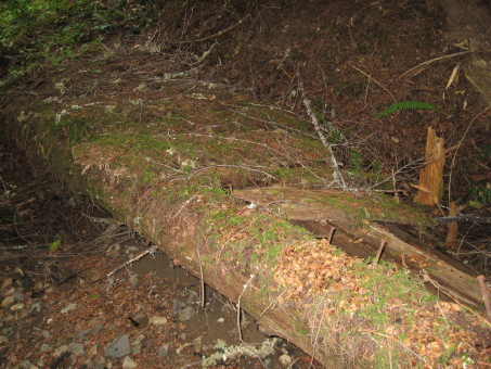
This is the largest footbridge that I have seen on this trail so far. Having my camera out I took some more photos of the trail just up the hill from the bridge. The next two photos show the before and after shots of a section of trail that somehow got cleared of brush and dog.
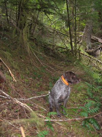

The trail is still there just like they left it 50 years ago.
Another 100 yards or so the trail came to a marshy area with beaver dams pretty close to where the trail must cross, but I couldn't see it. Once I got past the dams I picked the tread right back up. When I turned around I saw an insulator on a tree, but when I took the picture all you could make out is a white blob on the side of a tree beacuse of the suns reflection.
The trail headed up the hill and came to a big slide area for the next 1/8 mile or so. I stayed above the slide or near the top, sometimes seeing pieces of tread. Came to a second creek, I believe this one is Sluice Creek and as I looked around I saw another insulator and this one still had wire in it coming down to the ground. I forgot to take a picture.
I crossed the creek and didn't see tread for while until I came upon a cut log or two out a 100 yards or so. This tread started to go faint in this flat area, so I came back aways and found some more cut logs going in a different direction. I remembered seeing a junction on the old '38 map, and was wondering if this was it. I was getting tired from 2 days of exploring, so I left that dilemma for another day. Here is a portion of the '38 map showing that section of the trail.

See you out on the trail.