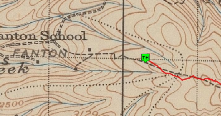
I recently checked out Fanton starting from the bottom, and noticed the trail on the other side of 4613 from the trailhead. It isn't signed, but is a lovely trail -- UNTIL the intense clearcut. It looked to me that the trail would of continued through the side of the clearcut but there is just too much debris to make it worthwhile to scramble. What seemed odd to me was the very clear recent maintenance on this small section of trail that didn't go anywhere.
Is this still the Fanton trail, or was this a different trail that used to have a destination? If so, where did it used to go, and are there any plans to repair the trail through the clearcut?
Thanks, Ryan
I saw that short segment the last time I hiked that trail last fall. I doubt there will be any attempt to resurrect it since there is no real good destination for it now.
Based on the 1938 map (you can see it on the maps page here), I believe it used to go all the way to the Fanton School. You can see the existing trailhead on this map:

Those old maps you have up are great!
rf said
Those old maps you have up are great!
If you like the old maps, you should try the map overlays:
You can overlay two maps and change the opacity so the maps blend together - they don't line up exactly due to the different datums used, but they are close. I think it helps to figure out where some old trails might be located in relation to known points.
Yes, I've already checked them all out. Very nice.
