
With the rain hitting my windows and the wind knocking leaves off
my neighbors trees into my yard, I am glad I seized the opportunity
to run to the mountains last weekend. I hope others did also, for the
the weather was perfect for hiking once the morning chill was off.
I once again returned to my labor of love the Cougar Creek Trail, but I
came in from the south this time near Signal Buttes. The patches of snow
near the top from last weekend's weather reminded me that access to
this trail is swiftly running out of time. Once I turned the corner on the
ridge the trail plunged into Cougar Creek canyon. After following the
faint trail and my old flagging about 1-1/2 to 2 miles I reached where I
had lefted off last July when I had ran out of flagging.
I picked up the tread and started flagging my way down, but the terrain
had begun to level out, and it wasn't long before I lost any sign of any
tread whatsoever. With no blazes to be seen I decided to just head down
to the creek which I could hear by now. I flagged my way eventhough
it wasn't trail, so I could find my way back out of there. I had only gone
about a 100 yards when I ran across a trail, which ended up being "the
trail", but I didn't know it at that time. I followed this trail about a 100
yards or so until it came to the infamous Cougar Creek. I crossed over
the 6-8 foot wide stream and proceeded to look for more sign of tread.
I went due west into a grove of cedars that looked like a trail was heading
for, but ended up just being a game trail. I was getting hungry, so I ate
lunch there and got out the copy of a piece of the 1938 map that I had
with me. The map showed the trail turned north after crossing the creek
for awhile before turning west again.
Having ate and rested, I headed back towards the creek crossing and
wouldn't you know it I stumbled upon a cut log not 50 feet from where
I had crossed the creek. There are not any cut logs down in this canyon
unless they where cutout of the trail. I had a cut log, but no tread. So I
headed in a northly direction following what looked like a game trail
heading towards a ridge in the distance.
After about an 1/8 mile, I came to a clearing at the bottom of a talus
slope that ran a 1/4 mile or so up the canyon wall. There before me was
tread beginning in that talus slope and heading right up the hill out of the
canyon. It wasn't long before I was into a mass of rhodies, but I didn't
care, for I was onto tread again and the flagging proceeded. Looking
over my right shoulder I could see the northern most Signal Butte
through the trees. It was nice to be able to see the otherside of the
canyon for a change.
Not wanting to stop what I was doing, but knowing that it would take me
at least a couple of hours to climb back out of here, I turned around at
3pm and headed back out of the canyon. After crossing the creek, I tried
to find the tread that would take me back to where I had losted it earlier
in the day, but was unable to locate it. So I just angled up slope and ran
into my flagging and the tread about half way up out of the canyon. I
reached my rig at 5pm with the sun low in the sky and a chill beginning
to come on.
I know it probably won't be until next summer before I can get back
down to where I had lefted off on locating this trail, but I know that
there are only more surprises to be found on this trail amd I want
to be the one who finds them.
P.S. I will post some photos when I get them downloaded and resized.
Photos from Cougar Creek:
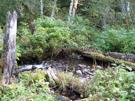
Cougar Creek at trail crossing.
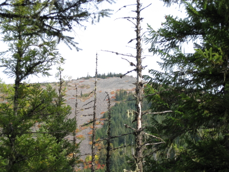
Northern Signal Butte through the trees.
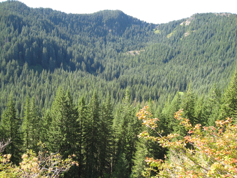
View from the trail looking down into Cougar Creek.
This was taken on my way out of the canyon and the
bottom of the canyon was already shaded at about 4:30pm.
.jpg)
A section of the old 1938 map showing the Cougar Creek Trail.
Hey look at that -- PICTURES!
Donald Presley said:
Photos from Cougar Creek:
Cougar Creek at trail crossing.
Northern Signal Butte through the trees.
View from the trail looking down into Cougar Creek.
This was taken on my way out of the canyon and the
bottom of the canyon was already shaded at about 4:30pm.
A section of the old 1938 map showing the Cougar Creek Trail.
Great stuff Don!
Started sanding my crosscut and trying to find the needed bits. Hope to start filing soon. Ebay is crazy right now for tools, $50 for a jointer? Fahgitit.