What is the fire history of the area? It may have had openings. I do seem to recall that either miners or Mr Bagby put their stock up there.
There are other names that have stories. Timothy Patch. I was told it was a natural opening of timothy that people drove stock up to from Dodge, Springwater. The Narrows. A place to get the animals gathered up.
Don2
Edit: Correction I think I mixed up "The Bars" with "The Narrows".
I do seem to recall that either miners or Mr Bagby put their stock up there.
Bagby was a miner!
There was a large formerly heavily used horse camp above Pansy Lake which was "rehabilitated" by the FS and is no longer as obvious as it once was.
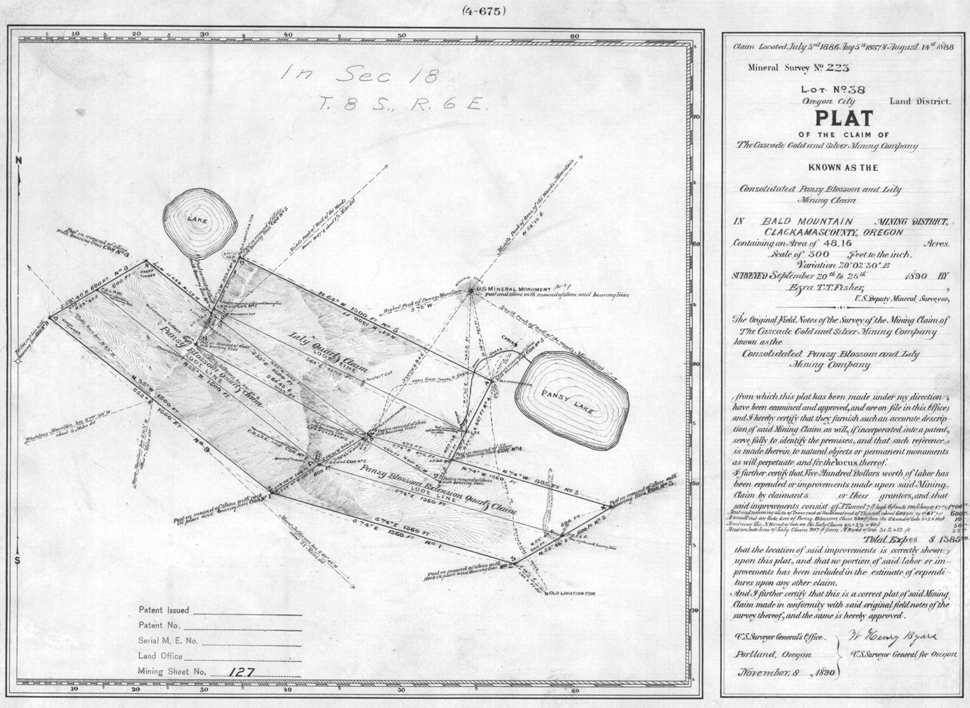
I suspect the nearby mine shafts were Bagby's, but unfortunately the mining claim paperwork was filed under a business rather than personal name. The claim was never fully proved up so now we have a wilderness area with a mine in it and rusting mining equipment. The quartz vein involved petered out quickly so there was never enough ore to justify a full mining operation. Another words the glacier took out the potential mine. It is known that Bagby spent years prospecting in the Clackamas.
Bryon
Donovan said
I do seem to recall that either miners or Mr Bagby put their stock up there.
Donovan,
Your memory is good, as always.
Oregon Geographic Names by Lewis McArthur has a listing for Farm Creek: "Farm Creek lies in T7S, R6E. It was named by Joe Davis, Jim Russell, Andy Wyland and Joe Dickey, who prospected and mined in that part of the county in the 1880s. They found good horse feed at the head of Farm Creek and left their stock there to pasture, calling the place The Farm."
Interesting that there is no listing in the same book for nearby Dickey Creek, but one would think that it might be named for Joe Dickey, or perhaps someone else in the Dickey family for whom Dickey Prairie was named.
You guys are AWESOME! This is cool historical info.
Visiting the mines around Pansy Lake is on my "to do" list.
Bryon, where is the old horse camp located? That would be fun to explore when I go look at the mines.
Rob Williams said
Visiting the mines around Pansy Lake is on my "to do" list.
Bryon, where is the old horse camp located? That would be fun to explore when I go look at the mines.
It's uphill to the West-Northwest from Pansy Lake. I can recall the remains of enclosures there but those are now gone. The Forest Service rehab job did not take so look for the area with few or no plants under the trees and a carpet of old rotten wood. There is a lake North of the horse camp which served as a watering trough in the Spring. The original miners trail goes right through it with a detour to the East for when it was full of very green water.
The main mineshaft trail is now blocked but a little bushwhacking will get you there. In 1996 not only did the portion close to the Lake turn into a creek complete with channel but a six-foot thick Doug fir dropped the long way down the old trail. Head uphill left - South of that fir and cut left when you find the trail. It isn't far after that.
I'm planning a June trip up there to find the other small shaft and the cut. I have a geologist interested. I also want to visit Strongbox Lake which is near the top of the ridge that divides Pansy from Bagby just above the green lake mentioned above. It appears to be a 500 ft. very steep climb through the trees from there.
Bryon
Here is the 1890 mining claim map:

