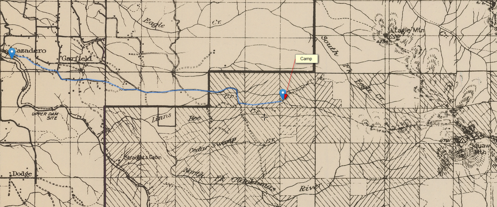
Here is a brief account of a Mazamas hike to Squaw Mtn in May 1920. Anyone recognize the trails that they were on?
Download Squaw-Mtn-trip-Mazamas-1920.pdf
They would certainly have taken the Fanton and Old Baldy trails that exist today to get up to the lookout. Farther west, I'm not seeing what trail(s) they might have taken from Faraday. There does show one trail segment around Bee Creek that they reference, but it doesn't seem to connect to anything really.
I wonder if they might have walked on roads from Faraday to Fanton. The writer doesn't mention a trail until the second day, probably beginning at Fanton. He also mentions that several parties arrived at the campsite by automobile, so they had to have been near roads at least some of the time. I don't understand why they would go to Bee Creek though as that seems out of the way. Maybe he meant Fall Creek.
Ever been on a hike with 87 people? I guess solitude wasn't part of the deal for these guys.
Doug Firman said
I wonder if they might have walked on roads from Faraday to Fanton. The writer doesn't mention a trail until the second day, probably beginning at Fanton. He also mentions that several parties arrived at the campsite by automobile, so they had to have been near roads at least some of the time. I don't understand why they would go to Bee Creek though as that seems out of the way. Maybe he meant Fall Creek.Ever been on a hike with 87 people? I guess solitude wasn't part of the deal for these guys.
I think you might be right - It sounds like the camp might have been at Fanton (the end of the road almost). They said the trip up to Squaw Mountain and back was 14 miles, so 7 miles seems like about the distance from Fanton to the top. I laid out this route on the 1916 map on roads that appeared on that map, and from Faraday to Fanton would have been about 8.5 miles according to this, so that is close to their reported 10 miles. But it didn't go by Bee creek - this map shows it as Linns creek, but it is now Fall creek.

I'm also not sure what "stream" they would have stopped at near the summit. I don't recall any streams, and the maps don't show any. Maybe it was more of a spring or something.
Where did you see that it was 87 people on this trip? I didn't see that in the report. With 87 people there wouldn't be much solitude! But I'm sure it was quite the adventure in that day and age.
Rob Williams said
Where did you see that it was 87 people on this trip?
It's at the end of the first paragraph of the report. I suppose that's what being a member of a hiking/climbing club like the Mazamas was all about. Can you imagine hiking down from Squaw Mtn on that day while they were going up and having to stand aside to let 87 people go by?
