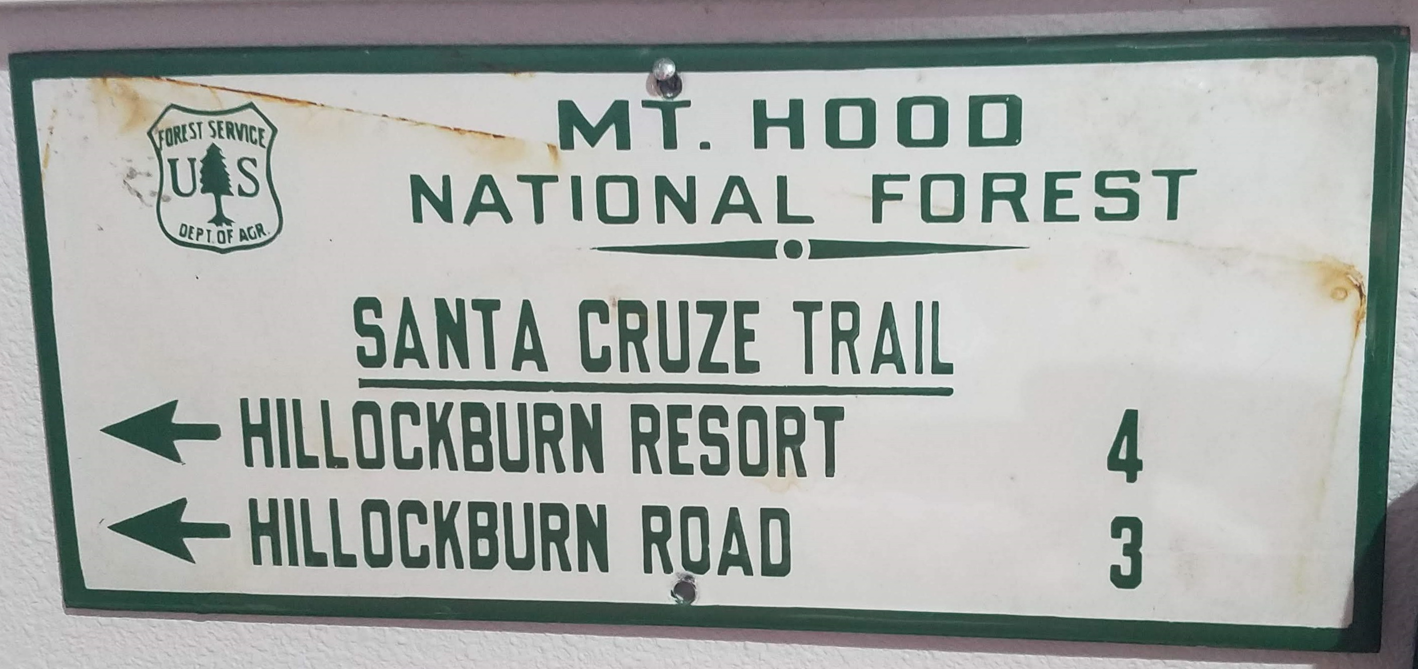
I'm not sure where this sign used to live when it directed travelers to the Hillockburn area. I'd never heard of a Santa Cruze Trail.

Do you have any dating on this sign ? It has been many the decade since the FS has made signs like this. Do you have the actual sign or just this photograph?
I've asked some Estacada folks and no one remembers that trail name or a trail to Hillockburn Rd or a Hillockburn resort. Of course maybe it was on the far side of Hillockburn rather than the Estacada side.
This sign currently resides at a customer's house in the Springwater area. Next time I'm out there I'll see if I can take a look at the back of the sign for any more clues. One possibility is that is was at the intersection of trails 516 and 514. The mileages would be about right.
The other thought I had was that the sign was made as some sort of prank or inside joke.
I wonder if the Hillockburn Resort might actually have been some sort of church camp. The old maps show a cabin north of the springs which was on a large piece of land owned by Portland Presbyterian Church. The road to that area is labeled on some maps as "Resort Road." Could that have once been part of a larger camp, referred to by some people as a "resort?" Just guessing here. It would be interesting to know the real story of the Hillockburn Resort.

I seem to remember the subject coming up a few years ago and a discussion happening in a thread on this forum (haven't found it yet). There are still remnants of a concrete structure out at the spring that appear to have been a swimming hole/pool. IIRC the church relocated their resort to a location in the Columbia Gorge. The area was pretty thick with young trees last time we were out there, but with the recent fires there might be more remnants visible now of the old resort.
