https://digitalcollections.ohs.org/oak-grove-project-intake
I think they must have reversed this negative. It seems like it's backward to me.
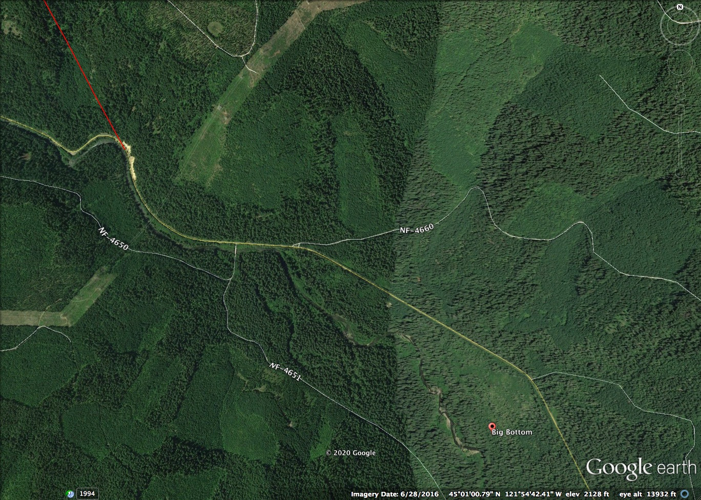
I drew a line in Google Earth to get an idea if the 20,000 ft. length is real. Sure enough, it could come out just below Big Bottom. At the time of this drilling, there was no road to that part of the river, so they would have started where they could get equipment to, Harriet Lake. What surprised me is that there is little elevation difference between the two ends, at water level according to Google Earth only around 25 ft. In the picture, the red line is my assumed tunnel route at 19978 ft. It could be shorter or longer but if its close to 20,000 ft. it shouldn't change much.
I've been looking thru all of those photos on the OHS site and am planning on putting a bunch of them on the Historical page. When going thru the photos, I saw a few names I hadn't heard before and wondered if anyone knew anything about them:
- Davis Ranch - was this where the Oak Grove Ranger station was? It kind of looks like it
- They talk about the "intake" - I'm assuming that has to be Harriet Lake, correct?
- I'm assuming when they refer to the "North Fork" they are referring to the Oak Grove fork of the Clackamas?
- I'd love to see a map where each of the camps were located - has anyone seen anything like that?
If anyone sees a photo they think should be included in the historical pages here please let me know. There are certainly a lot of photos to choose from on that site! I did grab the Ranger Station at Elk Lake.
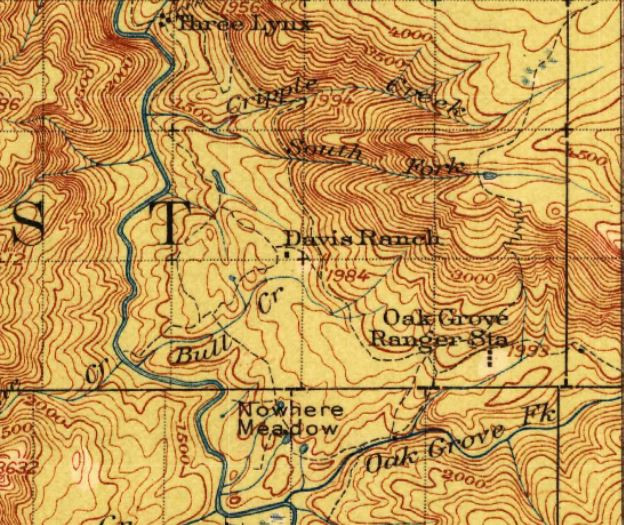
Davis Ranch and Oak Grove Ranger Station were two different places, according to the 1916 USGS Estacada map:

That's all I know about it.
Thanks Dave - I hadn't thought about looking at the old maps. That still looks like that area is privately owned - the current maps still show an in holding there.
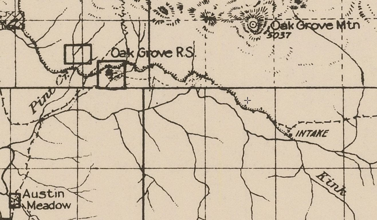
I also noticed on a different 1916 map, they show "Intake" where Harriet Lake is:

All the maps I see show the Oak Grove Fork as the Oak Grove Fork - so I'm still curious what fork they are talking about when they say the "North Fork"
