Sure, firstly, the approximate GPS coordinates are: 45.152756,-122.224315
Here are some photos of the place - First, a photo of what looked like might have been the "main" building, maybe 20'x40' or so:

Next, one of the many tags that were on tree rows:

Next, what looked like it used to be some sort of fenced off area:

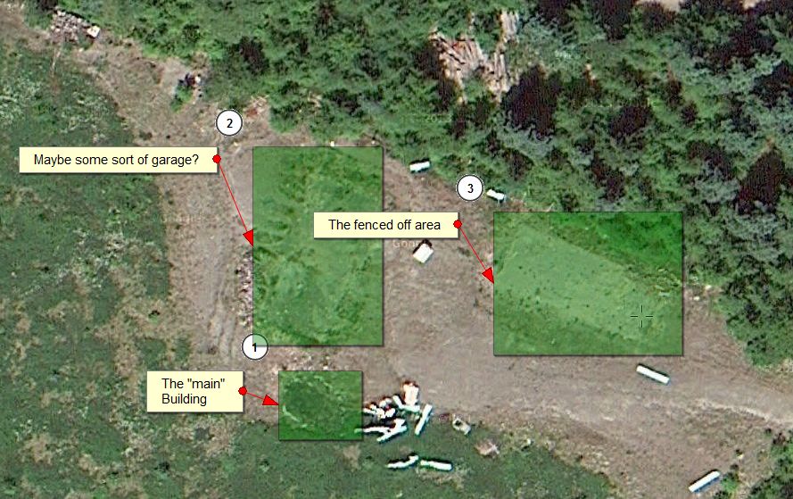
Lastly, here is an aerial image of the place:

And here is a link to an aerial photo you can pan/zoom, etc. You can see other things in the area - there is a fair amount of cut firewood that has been sitting for quite some time, and what makes me think the fire might have been unintentional is that there appears to have been filing cabinets and office chairs in that building that burned up. I would think that if they were closing the facility, they would remove the office furniture and any data from the filing cabinets before burning it down.
http://www.mappingsupport.com/p/gmap4.php?ll=45.152746,-122.224016&z=20&t=s
The last time I was through there, 3-4 years ago, all buildings were there. It's the usual slash and burn techniques the FS uses to remove buildings no longer needed and to wipe them off the books and the maintenance costs to keep them usable. It's the same way they burnt down all the old lookouts and guard stations throughout the forest. We now have one active lookout in our district, Sisi Butte, and one abandoned, the Bull of the Woods lookout and the cabin on Hawk Mtn. All of the rest, some 30+ buildings, were burnt down through the years. It's the same reasoning they use to abandon less travelled trails and remove the cost of maintaining them. I was told when I first volunteered to do trail maintenance that they wouldn't open up any old trails without removing equal amount of a current trail mileage from the books, for it would increase the budget for trail maintenance in the district. Even though we were finding all these old abandoned trails out there, the FS didn't want to open them. I'm sure others out there will concur.
Don
I think there was at least 2-3 buildings at that site Rob. We were in there checking out the Hillockburn Trail continuation across the South Fork that comes up just to the north of the old silviculture site.
From that aerial view, you can definitely see 2-3 "footprints" where something was. I know there was an outhouse there (it is now turned on its side with the roof removed) and then what looked like the main building, and another footprint that looked like it might have been a garage or something in addition to that fenced off area. Hard to know exactly what each thing was.
It is interesting that they buildings were there that recently, and interesting that if they did torch it, they left office furniture and potentially years of data in the building? That would be sad.
I'm just wondering what they were studying. Some of the tree tags said "clone" on them - don't know if they were experimenting with cloning trees or what.
Here's a Google Earth view I just pulled up - there is also a sizable gravel area nearby to the SW. This could have been a seed orchard or a test plot for the trees. I've run across an abandoned seed orchard before.
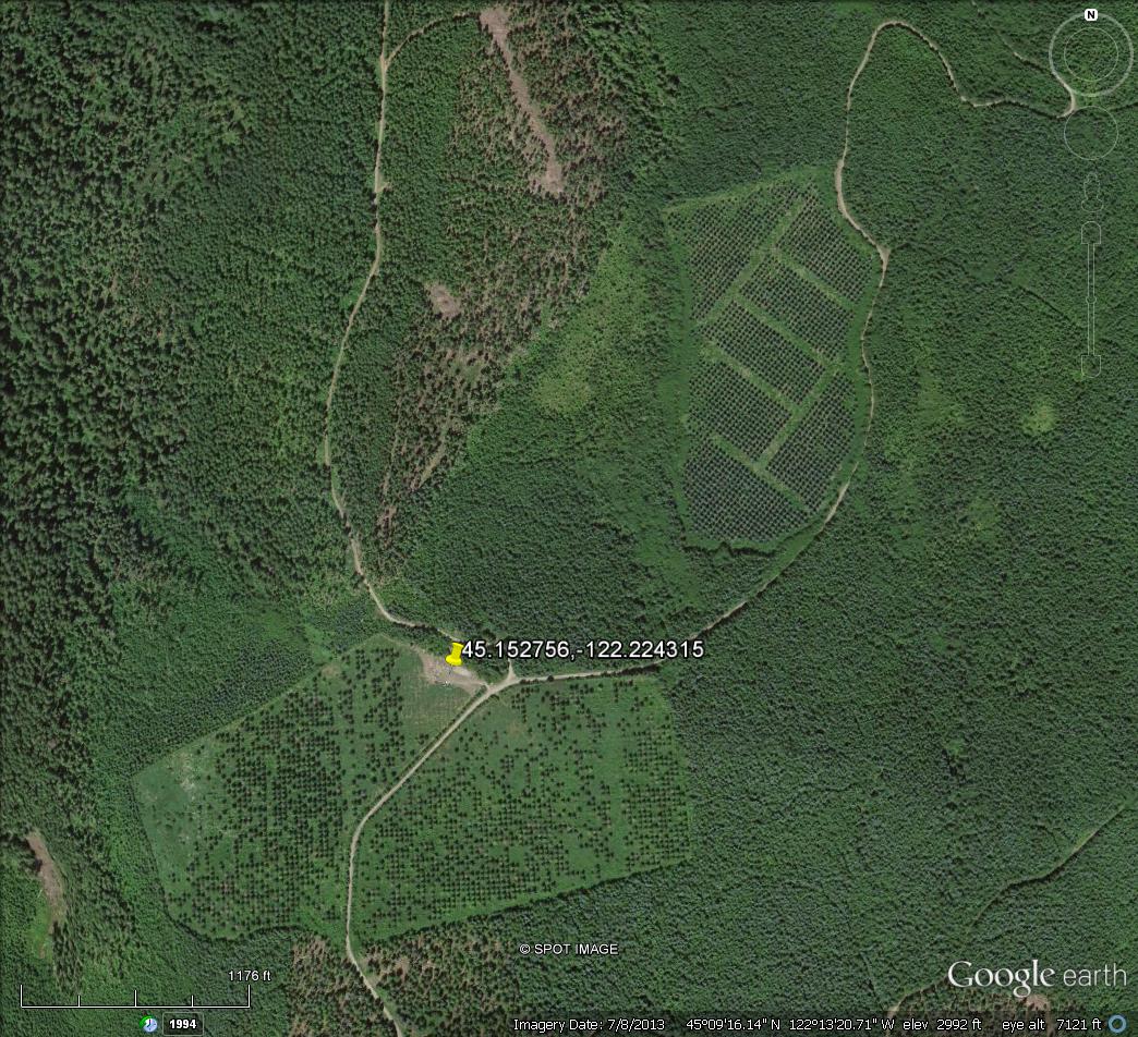
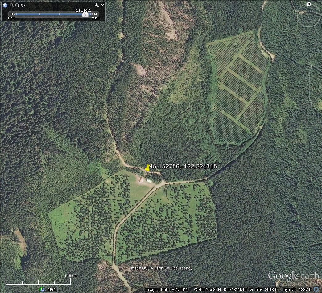
I tried Google Earth, and it does have aerials in B&W from 1994 and 2000, and in color in 2005, 2011 and 2013. Structures are present until the 2013 view. The 8/1/2011 one shows the 'garage' in rough looking shape but not burnt. It may have been heavily vandalized or partially torn down, the detail makes it hard to tell what the conditions really are. So the burning had to be after that date.
I'll see what more information I can dig up.
2013:

8/1/2011:

