I've been looking for info on the effects of the Christmas 1964 flood on the upper Clackamas. Here are a few photos that I've found.
Hwy 224 washout at Carter bridge .
Hwy 224 washout at Memaloose bridge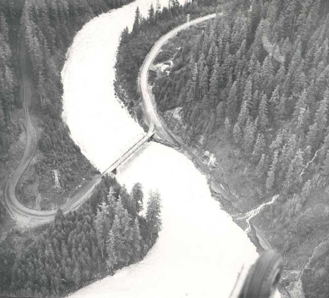
Cazadero Dam
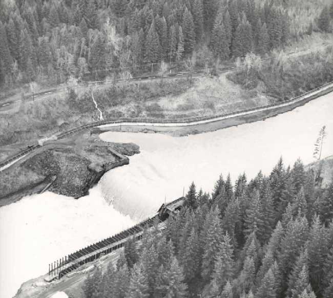
Faraday Dam
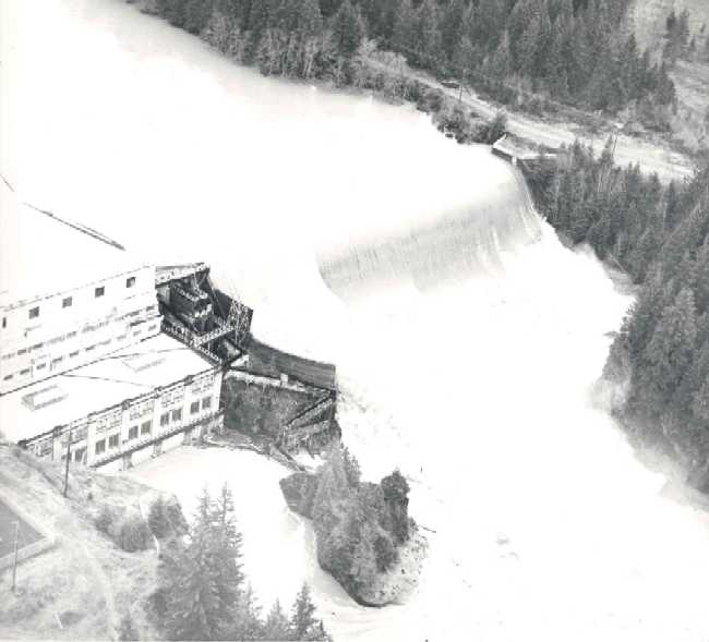
Logjam behind North Fork Dam estimated at 100 acres
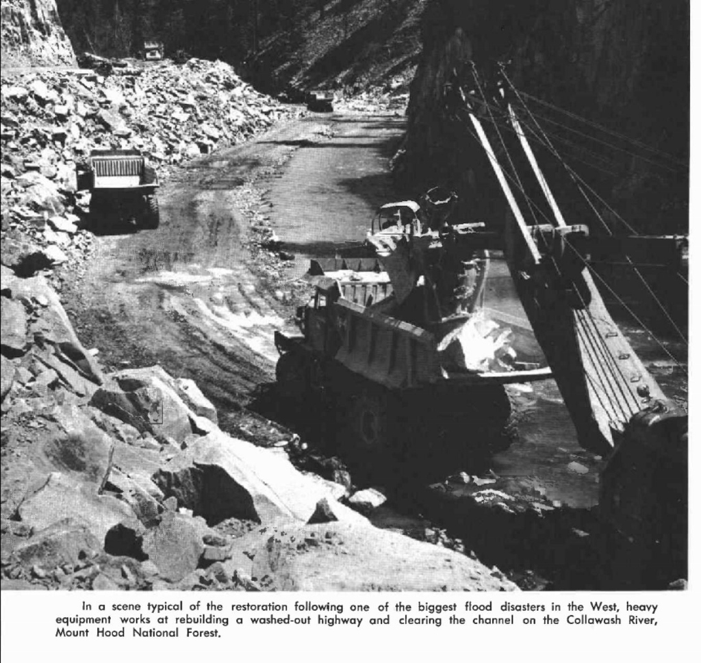
Collawash Road repair
It must have really been something to see, although not a good time to be out in the woods! According to PGE, the flood peaked at 86,900 cfs at Estacada at a height of 28.4 feet, a level 50 percent greater than the previous record in 1907. By comparison, the 1996 flood peaked at 68,900 cfs and a height of 27.6 feet.
Wow, Doug, those are cool photos. I wonder where the rest of Carter Bridge went?
And may I ask where you found them? I'm always looking for stuff like that.
There are also some other pictures of the rebuilding of road 63 in the Collowash canyon on the historical items page here on trailadvocate.org:
http://www.trailadvocate.org/historical-photos/
I doubt they would be able to use that heavy equipment in the riverbed like they did way back then. Although maybe there are improved methods that wouldn't require them to do that now.
At any rate, those photos you found show a very angry river. Thanks for posting them!
Regarding Carter Bridge, I don't know if there was any more to the bridge than that. It looks to me like the river eroded the land away at the end of the bridge. I haven't found any pre-1964 photos of that area so I don't know for sure.
I found those photos by googling "1964 flood Clackamas River." I don't remember the specific site, although I think it was a State of Oregon agency site. Lots of photos of the river at Oregon City, but not many from up in the forest.
Thanks for the link to the historical photos on this site. Somehow I missed seeing those before. interesting stuff. I wonder what the Collawash road looked like before the flood. It must not have been as substantial as it is now.
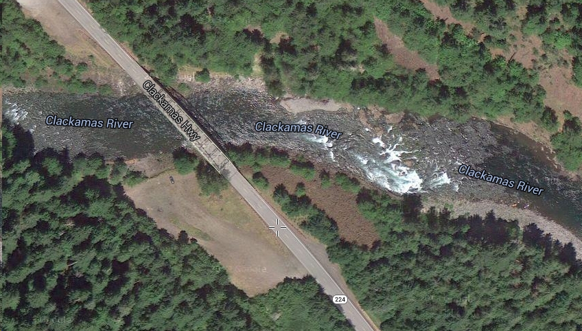
You know, I bet you are correct. That kind of makes sense now - I always wondered why there was that big gravel area on the south side of the bridge - I think that was all fill! If you look at the aerial view, I think you can kind of see the fill area, which looks suspiciously like the washed out area in the photo you posted:
I recently came across some articles from the Oregonian describing the 1964 flood damage. They provide some details about the Carter bridge move and the rebuilding of Hwy 224 up the Clackamas and Rd 63 along the Collawash. The 1967 article talks about how dangerous the highway used to be, and was known as "The Torture Highway." I can't recall if I was ever on that highway before the new alignment was constructed, but the thought of how it must have been with all the log trucks on the road makes me appreciate the easy drive it is today.
I saw a brief mention in another article (not one of the attached) which said that the Carter bridge move was accomplished for a mere $150,000 (the original estimate was $500,000). The story is that the flood caused the channel to be relocated, leaving the bridge more or less high and dry. So they moved it over to where it would span the new river channel. There was a detour in the interim using logging roads. That must have been an arduous detour, and it lasted for two and a half years.
Download Oregonian-28-Feb-1965.pdf
Download Oregonian-24-May-1965.pdf
Download Oregonian-13-Jul-1967.pdf
